
While many Texans were bracing for Hurricane Harvey’s landfall in late August 2017, a team of Texas university researchers set out to deploy instrument pods along the Texas coast. The information gathered from these Rapid Response Units (RRUs) could help develop more resilient coastal communities by improving predictive models and tools.
The Texas COAstal Storm Rapid Response (COASTRR) team is comprised of researchers from Texas A&M University – College Station and Galveston, and Rice University. Dr. Jens Figlus, assistant professor in the Department of Ocean Engineering at Texas A&M, is the principal investigator on this project. The team is specifically looking for information to help them understand if storm impacts will erode the beach; scarp, overtop or completely wipe out sand dunes; or if sediment deposits could require expensive clean-up efforts.
“When hurricane paths are forecast to hit a certain coastal area, it is important to know ahead of time what the impact to the coastal morphology is,” Figlus said. “Our field measurements of hydrodynamics and sedimentation during and after hurricane impact allow us to improve those predictive models and tools so they can then be used by federal, state and local agencies to issue notifications to the public, allocate resources and plan for the appropriate response based on expected local conditions.
Currently, rapid response field measurements of impacts to coastal systems from extreme storms such as Hurricane Harvey are difficult to collect. This is because of short notice preventing deployment of the instruments, potential of instrument failure or loss, and uncertainty of actual storm impact for specific locations.
“The work provides further advances to our capabilities to measure detailed hydrodynamic processes, such as currents and waves, across the surface of barrier island systems impacted by extreme events,” Figlus said. “This project is important to me because it combines fundamental work on better understanding our coastal systems with practical applications of rapid response to coastal hurricane impacts.”
To address the dilemma, COASTRR is trying to link measurements of storm hydrodynamics across stretches of barrier island systems during storm impact with observations of coastal morphology change in the days and months following the storm.
The researchers are specifically interested in infragravity waves produced by hurricanes and how these low-frequency water surface motions affect coastal erosion and accretion patterns, as well as associated damages of these massive storms.
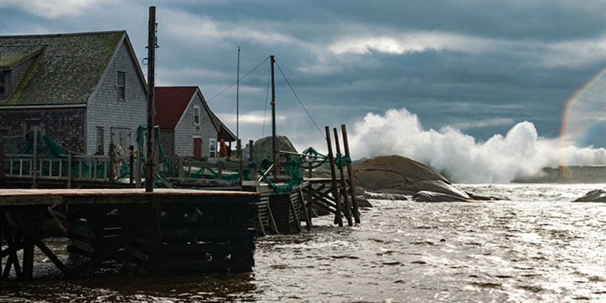
Similar to how the different frequencies of light waves from the sun can create different colors in a rainbow, water waves in specific frequency ranges hitting a coastline can have very specific effects on the coastline.
Hurricane Harvey presented a wide range of effects on the Texas coast, including complete devastation and major erosion near landfall, as well as the deposition of sediment, called accretion, at other locations.
As a result of the work the COASTRR team conducts, future coastal management decisions will be improved through a more detailed understanding of how storms reshape coastal barrier island systems. The information will also be incorporated into classroom teaching, ongoing outreach activities and publications to the research community.
Read the complete Texas A&M Engineering News article.