By Eva Vigh
If Russell Meier had not been a U.S. Army Corps of Engineers natural resource specialist, he might have been more worried about the rising flood waters at Somerville Lake during the 2016 Memorial Day weekend. For days, the weather across southeast and Central Texas had gone from bad to worse, with severe storms bringing huge amounts of rain to the regions.
Inside his office, Meier calmly watched the rain pour down. He knew Somerville Lake could take the floods.
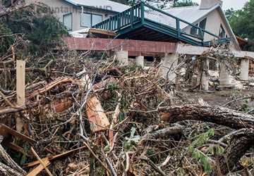
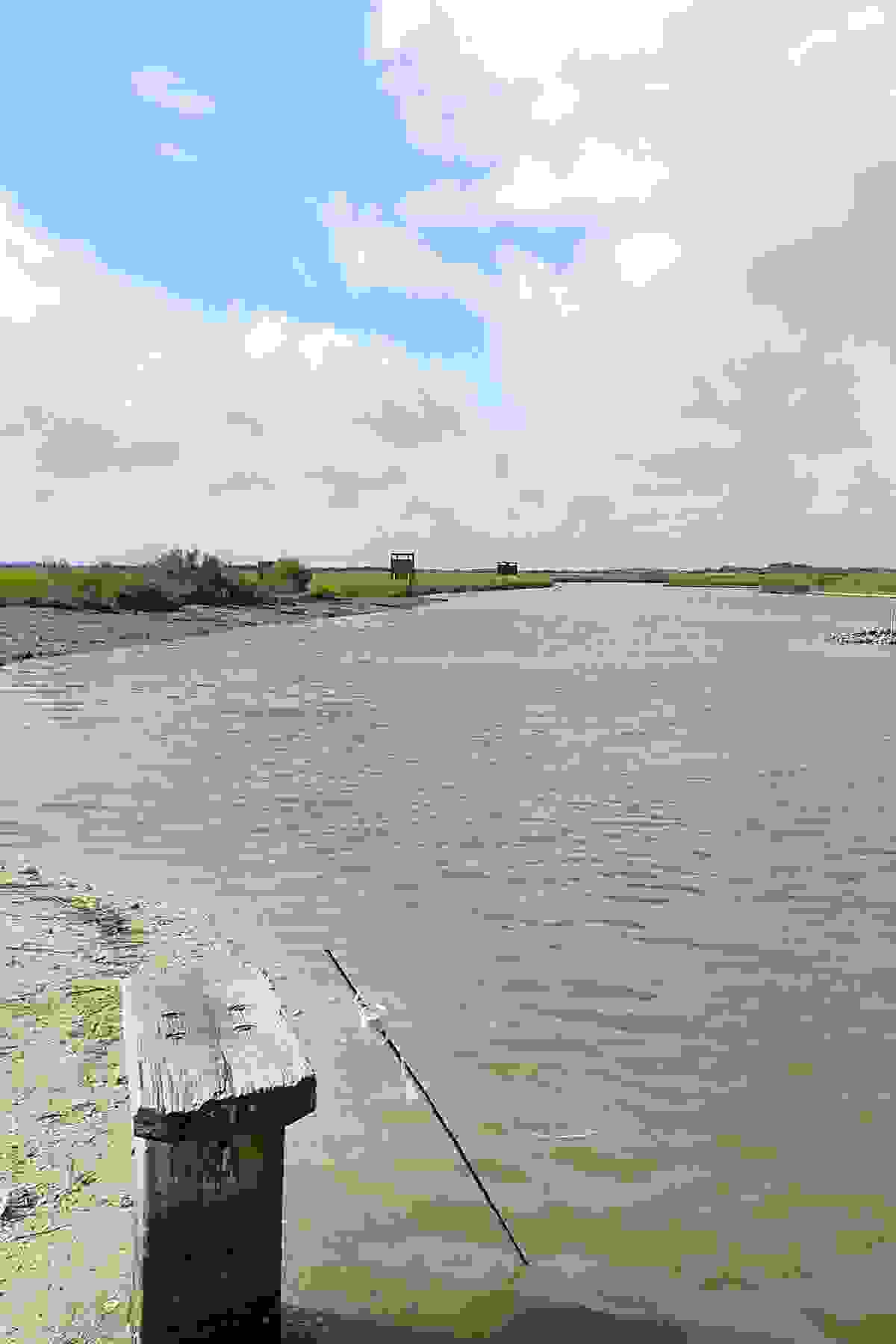
The storms hit northwest of Brenham, Texas, just before the weekend. Somerville Lake’s shoreline nearly disappeared as water levels continued to climb. Park benches and tables were completely submerged. By May 29, the lake had not only risen past its total water storage capacity but also shattered the previous record level set in March 1992.
Encompassing nearly 18 square miles, Somerville Lake, built and operated by the Corps Fort Worth District since 1967, is a reservoir in the Brazos River Basin designed to provide flood control as well as water for downstream communities, lake recreation, fisheries and wildlife.
While the lake reached record levels in May 2016, it also prevented major flood damage in nearby Burleson and Washington counties.
“If the water is too high, the lake is designed to hold that water back to prevent further flooding downstream,” Meier said.
The reservoir is built to hold a specific amount of water in its conservation pool and also have the additional capacity to hold a certain amount of floodwater. Its conservation pool water level is 238 feet above mean sea level, and its flood pool storage level is between 238 and 258 feet.

Without the lake’s flood storage, nearby communities would be more susceptible to flooding from Yegua Creek or the Brazos River, Meier said. If water levels reach more than 258 feet, water is released through an uncontrolled spillway and the lake is considered to be in flood status.
“Think of a 5-gallon bucket,” said Travis Stanford, a Corps hydraulic engineer. “When Somerville is at the top of its conservation pool, the bucket is about 30 percent full. When it’s at the top of its flood pool, the bucket is completely full. Once it gets completely full, it starts to spill over the bucket. That’s what’s happening with the uncontrolled spillway.”
Except during times of extreme rain, the flood storage pool is usually empty, Stanford said.
However, the May rainstorms were nothing short of extreme.
From May 14 to June 5, 14.5 inches of rainfall accumulated over the drainage basin that flows into Somerville Lake, he said. On May 27 alone, rainfall measured 6.3 inches.
“On May 29, when the lake reached peak flood storage, at 113 percent of its flood storage capacity, the flood water stored was 393,000 acre-feet,” Stanford said. “To put that in perspective, that’s enough to cover a 614-square-mile area 1-foot deep, which is about the area of Washington County.”
If the water is too high, the lake is designed to hold that water back to prevent further flooding downstream.
In its nearly 50 years of operation, there have only been two other times the water level went over the spillway crest in an uncontrolled release — March 1992 at 259.61 feet and May 2015 at 258.33 feet. In May 2016 the lake set a pool of record at 259.82 feet.
“It’s not an inexhaustible supply of flood storage space because it’s not possible to build a lake that would contain every conceivable flood,” Stanford said. “So at that point, Somerville has an uncontrolled spillway.”
Once the water level drops below the spillway crest, the floodgates can be activated to release more water at a controlled rate.
So, why did Somerville Lake remain flooded for months after reaching those historic levels?
The answer lies downstream. Releasing too much water, too soon, could flood the Yegua and Brazos, and damage nearby communities, Stanford said. The lake must be drained slowly.
The maximum nondamaging release out of Somerville Lake is 2,500 cubic feet per second (cfs); flow rates above that can lead to flooding in Yegua Creek, Meier said. During the 1992 floods, flow rates hit 5,000 cfs. Meier saw those rates nearly double in the recent floods, reaching about 9,400 cfs. Those were large amounts, but they were significantly lower than if the dam had not been there, he said.
“That’s why it takes so long to drain the lake,” Stanford said. “We could push more water out, but if you push more water out into the downstream and rivers, and then they get local rain, it’s that much quicker for them to experience flood damages.”
Reflecting on the lake’s performance, Meier said Somerville operated according to its design.
“It performed perfectly. We got up to that level, we engaged the uncontrolled spillway and water went out of it. Once we got back down to below that, we were able to open the flood gates and release water that way.”