By Sara Carney
Many students learn in grade school that 70 percent of the Earth is covered with water. Ask anyone where to find this water, and they will probably talk about oceans, lakes and rivers. They might mention groundwater or frozen water trapped in glaciers. But, they probably won’t mention water in soil.
Instead of running off into surface water bodies or percolating into groundwater aquifers, this water is stored in the soil. The amount of water retained in soil accounts for about 0.05 percent of the Earth’s freshwater, according to the U.S. Geological Survey (USGS). While that percentage may seem small, it is enough water to fill 6.6 billion Olympic-sized swimming pools.
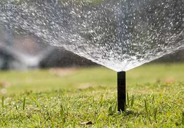
Soil moisture contributes to weather and geophysical conditions, such as drought and heat waves, and people rely on it for agriculture.

“Soil moisture is the basis of a lot of land management and land use decisions,” said Dr. Cristine Morgan, a soil scientist in the Department of Soil and Crop Sciences at Texas A&M University.
Globally, soil is coming to the attention of many as a vital resource. The United Nations Food and Agriculture Organization declared 2015 as the International Year of Soils.
“As people start to take a holistic problem-solving approach to global problems, they are seeing the importance of soil,” Morgan said. “The International Year of Soils is a result of others recognizing that we need to be paying attention to the soil.”
And taking a holistic approach, they are. Scientists are beginning to understand soil moisture’s role in the water, carbon and energy cycles, as well as its impacts on drought, flooding, crop yield and extreme weather and climate conditions.
Soil moisture is the basis of a lot of land management and land use decisions.
Recent efforts by NASA, the University of Texas at Austin and Texas A&M use different monitoring strategies, including satellites and in-ground sensors, to tackle unanswered questions about soil moisture.
A view from space
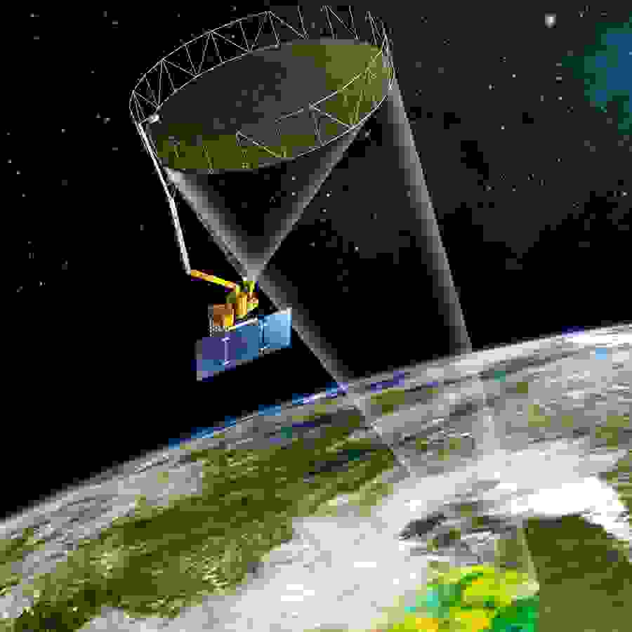
It may seem counterintuitive to go into space to study something beneath their feet, but scientists are. Scientists can use satellites to see soil at a scale too large to observe from Earth. To get an unparalleled global glimpse of soil moisture, NASA launched the Soil Moisture Active Passive (SMAP) satellite in January 2015.

“SMAP is going to help us not only address key science questions, such as better understanding our water, carbon and energy cycles, but also a number of different applications, such as enhancing weather prediction; improving flood, drought and wildfire forecasting; and enhancing crop prediction models,” said Dr. Erika Podest, Earth scientist at NASA’s Jet Propulsion Laboratory (JPL) in Pasadena, California.
What makes SMAP so unique is how well it can “zoom in” on soil moisture while still remaining accurate. “Before SMAP, most of the satellite missions measuring soil moisture were at a very coarse resolution,” NASA JPL Research Scientist Dr. Narendra Das said.
While data from those satellites was helpful in producing some climate and weather models, it wasn’t enough to produce real-time data for things such as agricultural monitoring and forecasting, Das said.
The “Active Passive” part of the satellite’s name refers to the instruments onboard, he said. SMAP’s radar actively sends microwaves to Earth, which echo off the Earth’s surface and return to the satellite for interpretation. The echo’s characteristics, such as strength, tell SMAP the amount of moisture in the soil and whether the land surface is frozen or thawed. Understanding freeze-thaw cycles will help scientists better define the length of the growing season at northern latitudes and understand the carbon uptake of vegetation, Podest said.
At the same time, SMAP’s radiometer passively measures the strength of radio waves emitted from the ground. This quantifies soil moisture with higher accuracy than the radar but at a lower spatial resolution. The combination of the radar and radiometer optimizes spatial resolution and accuracy and is unprecedented for any satellite mission, the experts said.
Unlike soil moisture measurements on the ground that analyze specific points, the SMAP satellite provides a global picture, which captures soil variability. A complete global soil moisture map is made every three days.
“The reason that we are producing these maps every three days is to capture the dynamic nature of soil moisture,” Podest said. “This will help us better understand the role of soil moisture in regulating the water cycle and whether certain places are getting wetter or drier.”
SMAP’s mission is set for three years, but Podest said it is expected to collect soil moisture data for years to come, as is the case with many NASA satellites.
Uniting data from the heavens and Earth
Before the satellite can generate its own data, scientists must check SMAP’s measurements against those of on-ground networks.
While there are many networks on the ground, most are sparse, with sensors that are spread out. While such networks are useful, SMAP also needs dense networks, or core validation sites. These networks have a higher density of sensors and allow SMAP to better characterize soil moisture at a higher resolution. According to Das, around 15 core validation sites exist in the United States.
It was previously thought Hill Country soil doesn’t hold much moisture, but new data indicates that it can.
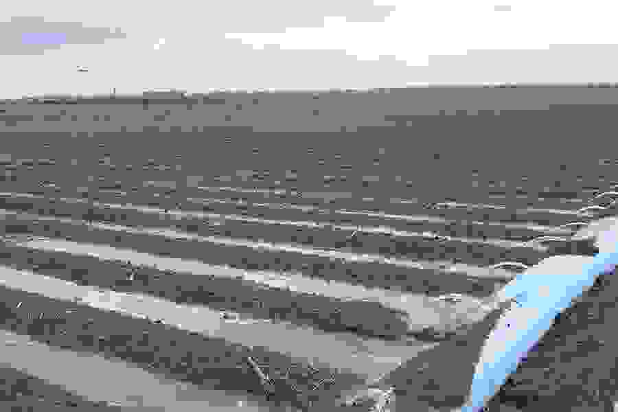
These sites are helpful, but most were not set up with SMAP in mind, he said. So, geologist Dr. Todd Caldwell and his colleagues at the University of Texas’ Bureau of Economic Geology stepped up and built the Texas Soil Moisture Observation Network (TxSON), a dense network of soil monitors in the Texas Hill Country. The network is the state’s first dense network.
“NASA is trying to produce the best soil moisture map within a certain tolerance,” Caldwell said. “And to do that, they need something to base it against, and that’s what TxSON, as it is right now, is designed to do.”

Besides helping SMAP calibrate and validate its data, TxSON also provides much-needed soil moisture data to the Texas Hill County, Caldwell said.
“We’ve got a whole bunch of soil moisture data now in a completely unmonitored part of Texas, where people didn’t think there was a whole bunch of soil moisture variability,” Caldwell said. It was previously thought Hill Country soil doesn’t hold much moisture, but new data indicates that it can, he said.
Caldwell hopes TxSON can expand to other parts of Texas. Additionally, he foresees that someday the data will be translated into a form that is accessible to anyone who is interested, including land managers, river authorities and policymakers.
Soil moisture monitoring from coast to coast
TxSON is only one of many networks measuring soil moisture in North America, each created by a different entity with different research goals, using different measurements.
Comparing these datasets can be challenging. If a researcher wants to look at soil moisture in different areas of the country, they might find that they are comparing apples to oranges. Enter the North American Soil Moisture Database (NASMD).
NASMD integrates soil moisture data from across the United States, Canada and Mexico to create a comprehensive dataset for researchers and professionals. This data provides a historical look at soil moisture conditions, said Dr. Steven Quiring, a climatologist in Texas A&M’s Department of Geography, who is leading the NASMD project.
“The goal is that you can go on a single website, enter in a particular location and figure out what soil moisture conditions are in your location and how they compare to the historical record and what the trends are,” Quiring said.
The data gathered through NASMD will also help answer many of the pressing questions that climatologists have about the relationship of soil to the atmosphere and climate predictability. Soil moisture conditions can help predict extreme temperature conditions, he said. Also, soil moisture data may help answer whether wet soils lead to rainfall or dry soils do.
Directly observing and measuring soil moisture offers certain benefits over satellites. In-ground sensors can measure much deeper into the soil than satellites such as SMAP, which only measures the top couple of centimeters of the soil, Quiring said.
A companion project to NASMD being developed by Texas A&M and USGS will integrate several existing networks in Oklahoma and north Texas for real-time information on drought monitoring, Quiring said. A website will be created that farmers, ranchers and land managers can use to make informed decisions.
We know less about the soil than we know about space. It’s interesting how little we know considering how dependent we are on it.
“In the long term, understanding land-atmosphere interactions and the role of soil moisture can help determine how the frequency and severity of drought may change in the future,” Quiring said.
This project will serve as a testing ground to see if this is something that can be done at the national level, he said. A real-time system would facilitate disaster relief, and this data would help government officials in determining where to provide emergency aid.
A world of soil research remains
Despite recent strides made in soil moisture research, there is still much to be learned. “We know less about the soil than we know about space,” Morgan said. “It’s interesting how little we know considering how dependent we are on it.”
Traditional challenges associated with measuring soil moisture have not gone away. But, the researchers said facing these challenges could be worth it if the data helps answer age-old questions, such as “Will it rain tomorrow?” “What crop yields can we expect?” “How severe will the drought be this summer?”