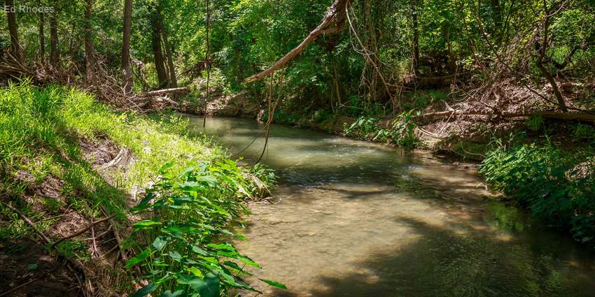
Rivers and streams are the veins that carry surface water. Have you given much thought to their health?
According to the U.S. Environmental Protection Agency (EPA), 55% of U.S. rivers and streams are in poor health partially due to insufficient vegetation cover and streamside disturbances, such as quickly developing areas, land conversions and the loss of vegetation from severe weather or wildfires, of their riparian areas. Riparian areas are the green vegetation zones along streams, rivers and lakes.
Restoring riparian vegetation cover throughout urban Texas rivers and streams is the goal of the Urban Stream Processes and Restoration trainings, part of Texas Water Resources Institute’s (TWRI) Urban Riparian and Stream Restoration Program.
In collaboration with Texas A&M AgriLife Research and Extension Center at Dallas, Texas Riparian Association, EPA and the Texas Commission on Environmental Quality, the Urban Riparian and Stream Restoration Program includes an educational program and demonstration site that began in 2017. The training instructors include Clare Entwistle, TWRI research associate; Dr. Fouad Jaber, Texas A&M AgriLife Extension specialist; and Nathan Glavy, Extension program specialist at TWRI.
In an attempt to shift attitudes toward stream repair, Entwistle said TWRI and project partners developed the program with the goal of introducing professionals and groups to natural stream design, stream classification and assessing degraded urban stream systems.
Unlike traditional repair approaches that rely on concrete for repairing degraded segments, healthy restoration identifies and corrects the causes of stream erosion and degradation.
Natural stream design focuses on maintaining and restoring the primary stream functions of transporting water and sediment and providing a habitat for wildlife by using stabilizing riparian vegetation and the engineered placement of existing riparian features such as rocks or fallen timber.
Entwistle said traditional restoration approaches rely heavily on hardscape techniques, including concrete channels, gabions and rip rap to stabilize banks.
“These engineered channels can work to reduce erosion and protect banks locally but can have unintended impacts upstream and downstream from the restoration site and do not preserve natural stream habitat to preserve the important ecosystem services that streams provide,” she said.
Stream degradation or erosion can lead to deep and wide channels that are disconnected from a water table or floodplain.
“This is usually a consequence from increased peak flows during storm or runoff events and a loss of stabilizing vegetation and can lead to reduced water quality, in-stream habitat, aquatic species and overall stream health,” she said.
Proper management, protection and restoration of riparian areas will
- decrease bacteria, nutrient and sediment loadings to water bodies;
- lower in-stream temperatures;
- improve dissolved oxygen levels;
- improve aquatic habitat; and
- ultimately improve aquatic community integrity.
Since 2017, there have been eight workshops across Texas with 213 participants, according to Entwistle.
“We have focused our trainings in urban and quickly developing areas, including Lewisville, Seguin, Austin, The Woodlands, College Station, San Antonio, Belton and Pearland,” she said.
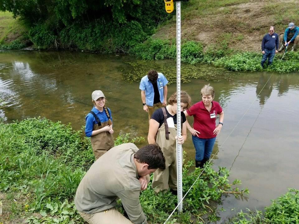
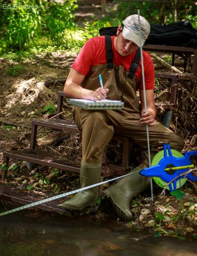
The one-day trainings begin with a morning session that consists of educational presentations about protecting water quality and restoring riparian buffers, stream classification and restoration, and watersheds and environmentally sensitive areas. In the afternoon session, participants learn stream-surveying techniques at a nearby stream. Attendees receive a certificate of completion at the end of the training.
“Stream design and construction, riparian re-vegetation, managing bare ground, limiting access to streams and photo monitoring were the practices most likely to be implemented by participants who have attended the trainings so far,” Entwistle said, “and 66% of respondent plan to take action or make changes based on information learned during the training.”
During the educational trainings, the team shares the data and observations from the project’s demonstration site.
“We are conducting a stream restoration demonstration on the benefits of restored and healthy riparian areas in the Geronimo Creek watershed,” Entwistle said.
Located in Seguin, Texas at the Irma Lewis Seguin Outdoor Learning Center, the demonstration site includes two stream sites that have moderate to highly erodible banks along Geronimo Creek.
“The goal of the site is to show that implementing stream bank re-vegetation along moderately eroded stream banks can reduce stream bank erosion and excessive sediment loading in the creek,” she said.
The team performs water quality monitoring quarterly, annually and during qualifying storm events at the demonstration site to evaluate erosion and sediment, or total suspended solids (TSS), in water quality.
“We put in riparian buffers along a 100-foot stretch of the creek using natural bank stabilization techniques and planting native vegetation,” Entwistle said. “Another 100 foot stretch was left untouched to serve as the control site.”
At the end of the project, Entwistle said they will compare results from the controlled and re-vegetated sites to show the benefits of increased vegetation cover on the banks.
Preliminary results show that over the first year, while both sites did accumulate sediment during storm events, the restored site had on average a smaller percent increase (13.18%) in sediment leaving the site than the percent increase (18.28%) at the control site.
The team also documents physical measurements to assess the changes in the stream bank from erosion, changes of TSS rates in the stream, and the change to the erosion hazard index ranking because of vegetation cover. Erosion pins, grab samples and assessment of vegetation cover and bank angle are also recorded to assess stream bank erosion rate and TSS levels in the stream.
In May 2020, TWRI will be hosting the 3-day, advanced stream restoration training at the AgriLife center in Dallas.
“This training will allow participants who attended the day-long workshops to go more in-depth on stream and riparian restoration topics,” Entwistle said.
Upcoming trainings and overall progress of the demonstration site are updated on the website.
Upcoming trainings:
- McKinney – Sept. 19
- New Braunfels – Oct. 29
- Waco – Nov. 14
- Corpus Christi – Nov. 19
Funding for this project is provided through a Clean Water Act Section 319(h) nonpoint source grant from the Texas Commission on Environmental Quality and U.S. Environmental Protection Agency.