
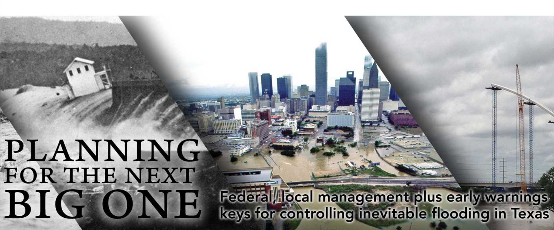
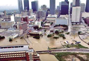
In May 2011, Texas was in the midst of the worst one-year drought in its recorded history. At many lakes, boat ramps stood isolated far from the water’s edge, and on many ranches, owners sold their cattle because their land couldn’t support the livestock. Four years later — May 2015 — Texas recorded its wettest month ever, and much of the state was experiencing major flooding. On Memorial Day weekend, roadways flowed like rivers in Houston, Austin and Dallas-Fort Worth, and in the worst areas, homes and people were swept away.
Figures from the Office of the State Climatologist at Texas A&M University show that May averaged 7.54 inches of rainfall across Texas, surpassing the previous record of 6.66 inches in June 2004. In the Dallas-Fort Worth Metroplex, it was the single wettest month since April 1942, with just under 17 inches.
This 180-degree change in weather conditions is not uncommon for the state. For instance, the drought of record of the 1950s ended in the spring of 1957 with massive rains. Every major river and tributary in the state flooded, causing damages estimated at $120 million, according to the 2012 state water plan.
Flooding is normal for Texas
Although flooding is an expected natural occurrence, most years Texas leads the country in flood-related causalities and damages. With increased population, urbanization and changing climate, the problem, experts said, is growing.
“There is nothing unnatural about flooding,” said Dr. Ralph Wurbs of Texas A&M’s Zachry Department of Civil Engineering. “Most streams are going to get out of their banks every few years. It’s when people are there (in the flood’s path) that it becomes noticeable because of the damages.”
Flooding in Texas is typically caused by either bursts of heavy rainfall or saltwater surges from tropical storms and hurricanes, sometimes both.
Most streams are going to get out of their banks every few years. It’s when people are there (in the flood’s path) that it becomes noticeable because of the damages.
Houston in particular is very vulnerable to both of those (heavy rain and saltwater surges) because of where it is located,” said Dr. Sam Brody of Texas A&M Galveston’s Department of Marine Sciences and Texas A&M’s Department of Landscape Architecture and Urban Planning.
He said flooding along the Texas coast is a chronic problem, punctuated every 15 to 20 years by tropical storms and hurricanes. In 2008, Hurricane Ike caused about $27 billion in damages. “Galveston is still recovering from that storm,” he said.
Dr. Philip Bedient of Rice University’s Department of Civil and Environmental Engineering agreed that flooding in Texas is increasing, along with losses from floods. “The state is getting more frequent floods, more devastating floods, and it will continue, especially in the coastal areas where we had huge growth and expansion of population,” he said.
The Dallas-Fort Worth Metroplex is not necessarily experiencing more rainfall events, but when it does rain, it tends to rain more, according to Dr. Dong-Jun Seo of the University of Texas at Arlington’s (UT-Arlington) Department of Civil Engineering.
“In North Texas, over the last 50 years or so, the rainfall amounts from heavy precipitation events have increased by 15 to 20 percent,” he said.
“If we hypothesize that the same trends will occur in the next 50 years, then we expect to see more extreme rainfall,” Seo said. “So far what we are seeing in North Texas is very much in line with what the climate scientists have been predicting.”
The state is getting more frequent floods, more devastating floods, and it will continue, especially in the coastal areas where we had huge growth and expansion of population.
For Brody, the issue is not so much the climate, which he agreed is changing, as it is humans. Increased population growth and urban development and the corresponding increase in impervious structures, such as commercial buildings, homes and parking lots, are exacerbating the flooding problem.
“Think about two gears. One small gear is moving very slowly; that’s climate,” he said. “One big gear, which is moving very quickly, is the people moving into vulnerable locations. And those things work to amplify the problem.
“Because of the proliferation of impervious surfaces across the landscape in Houston and other metro areas, there is nowhere for the water to run except into people’s homes.”
A brief history of flood management
Efforts to reduce and manage flooding range from building dams and levees to passing local ordinances that prohibit building in flood-prone areas. Since Texas doesn’t have a statewide flood control plan, most efforts fall on the federal government and local communities.
Wurbs said the federal government, by way of the U.S. Army Corps of Engineers, got into the flood control business in the 1930s after a series of disastrous floods, especially those along the Mississippi River. The 1936 Flood Control Act gave the Corps the authority to control flooding by building and operating flood control reservoirs. Throughout the United States, the Corps built more than 500 dams with about 30 in Texas.
The Corps also builds levees and channels to manage flooding, including the Dallas Floodway along the Trinity River and the San Antonio River Walk, which is part of the San Antonio Channel Improvement Project.
Along with the Corps, the U.S. Department of Agriculture’s Soil Conservation Service, now the Natural Resources Conservation Service, assisted local entities in building nearly 2,000 earthen dams on private property to prevent and control flooding.
In addition to structural flood control efforts, Congress established the National Flood Insurance Programin 1968 to encourage wise development in floodplains, or the areas around lakes, rivers and streams prone to flooding. The Federal Emergency Management Agency (FEMA) manages the flood insurance program. For citizens to obtain flood insurance, their cities have to participate in the flood insurance program, which requires cities to adopt and enforce 100-year floodplain management regulations to reduce future flood risks for new construction.
On a local level, communities manage potential flooding through their stormwater management programs and development regulations. Structural defenses include drainage and detention basins that capture excess water and slowly release it to nearby streams.
Researchers study flood control solutions
The experts said better flood management involves short-term and long-term, structural and nonstructural solutions. Some of the long-term answers, such as flood control dams, are becoming too expensive, so communities are turning to other answers.
Brody and other researchers have conducted a number of national studies on what can be done to control flooding. They looked at a range of structural and non-structural mitigation techniques; two stood out.
The first technique, a type of vertical avoidance, was building structures above the expected 100-year flood water level, which is called freeboard. “We have found that communities that have freeboard requirements are saving on average $960,000 in avoided flood losses per year,” said Brody, who is also director of the Institute for Sustainable Coastal Communities at Galveston.
The second major mitigation strategy was protecting open spaces around bayous, streams and floodplains. He said communities that move structures back from these areas save about $500,000 a year.
I really think putting this information in the hands of the residents and decision-makers is going to create more effective actions at the community and household level.
Visualization tools that help individuals and community leaders see the consequences of building in or near the floodplain can help, Brody said. The Center for Texas Beaches and Shores and the Hazard Reduction and Recovery Center at Texas A&M developed a web-based Texas coastal atlas that allows users to visualize the consequences of living in these vulnerable areas. The atlas covers 29 coastal counties.
“If you are a resident, you can see where you are in relation to the floodplain,” he said. “If you are a decision-maker, you can see here are my risk zones; here is where my population is; here is where it is growing.”
Then, Brody said, decision-makers could ask the question: ‘What can I do to create incentives or regulations to help my community grow in the future in a more resilient fashion?’
“I really think putting this information in the hands of the residents and decision-makers is going to create more effective actions at the community and household level,” he said.
Seo said improving flood control infrastructure is a long-term solution but one that will be very expensive, maybe too expensive, especially with uncertainty in rainfall amounts and extreme swings in the climate predicted.
“Due to climate change and urbanization, it has become much more difficult to model, assess and predict what these flooding risks are like,” he said. “In the past, we assumed the climate on average stayed the same. Then we could extrapolate what may happen in the future based on what has happened in the past. But because of these changes, we can’t assume that anymore.”
Brody said a multiuniversity group recently received a $3.6 million grant from the National Science Foundation (NSF) to conduct research and education on flood risk reduction. One of the questions the scientists will be answering is which flood mitigation techniques, both structural and nonstructural, are most effective in reducing the adverse impacts of floods?
Warning system aids in flood-response decisions
Since flooding is inevitable, the most viable solution may come down to warning systems to make a difference in decreasing the damage and loss of life from flooding, the experts said.
In the late 1990s, Rice’s Bedient, who is also director of the Severe Storm Prediction, Education and Evacuation from Disasters Center, developed a radar-based flood warning system for the highly urbanized, flood-prone area around the Texas Medical Center in Houston, which is in the Brays Bayou Watershed. The Flood Alert System is an integrated system using radar, rain gauge information, bayou stage data and hydrologic modeling to predict the overall threat of out-of-bank flooding of the bayou near the medical center. National Weather Service (NWS) radar data gives the system rainfall information every five minutes for a 1-square-kilometer area. “It’s like having hundreds of rain gauges, so it’s very accurate,” Bedient said.
Before the alert system, Bedient said, “We would watch bayous rise, and we would use the rising rate of the bayou to indicate flooding potential. The problem with that is it doesn’t say anything about what is going to happen next.”
We would watch bayous rise, and we would use the rising rate of the bayou to indicate flooding potential. The problem with that is it doesn’t say anything about what is going to happen next.
After Tropical Storm Allison dropped around 20 inches of rain on the medical center over five days in 2001 and caused $2 billion in damages, Bedient was funded to expand and enhance the system.
The current system gives the Texas Medical Center two to three hours of notice that a flood is going to occur.
“So now with this system in place and with all the improvements — flood gates and doors and other things — in the med center, they can lock it down and protect against even the 500-year flood in less than an hour,” Bedient said.
Through the years, the Flood Alert System has a successful track record, providing sufficient warning times before more than 50 major storms, including Hurricane Ike in 2008 and the 2015 Memorial Day weekend, when 7.6 inches of rain fell in 12 hours over Brays Bayou Watershed.
Partnership developing integrated, Metroplex-wide warning system
The 2015 Memorial Day weekend also brought massive flooding to the Dallas-Fort Worth Metroplex. Cars were stranded on major highways, and a mobile home park was partly submerged by high waters. A Grand Prairie apartment building was evacuated — twice.
It is that type of flooding and other severe weather in the Metroplex that has propelled a partnership of universities, governmental agencies and private businesses to work on developing a warning system for the region, Seo said.
“There is a very strong need to have an integrated flood warning system for densely populated urban centers to provide early, accurate and location- and time-specific warnings for millions of people,” Seo said. “What we need is much improved observing systems for these flood-causing atmospheric conditions and on-the-ground flooding conditions as well as communications systems that can gather data and transmit information to everyone fast, just like traffic information systems.”
Through the Collaborative Adaptive Sensing of the Atmosphere, or CASA WX, Seo said the group has deployed five low-cost weather radar systems that provide very high-resolution rainfall information along with severe weather information, such as damaging winds, tornadoes and hail. Unlike NWS radars, CASA WX uses smaller, faster-scanning radars that cover the lower atmosphere where a majority of severe weather takes place. Plans call for eventually deploying 16-20 CASA WX radars in North Central Texas.
The CASA WX radar system is part of a five-year, $10 million NSF project with the North Central Texas Council of Governments to create an urban test bed in the Metroplex to demonstrate improved hazardous weather forecasts, warnings and responses in a densely populated urban environment.
Seo said this warning system will give users very detailed flooding information based on high-resolution observations and hydrologic and hydraulic modeling.
If we can harvest in real time various flooding and related water information from citizens, then that information can be used along with model results to warn people with more lead time and additional accuracy.
Currently the early warning model is subscription-based supported by annual fees collected from participating cities, he said, but the goal is to make the system available to residents in the future.
Also part of the effort to develop an early warning system is a four-year, $1.2 million NSF-funded UT-Arlington project on urban water sustainability. The partnership of universities, governmental agencies and private businesses is developing a regional cyber infrastructure for observing and modeling urban water and generating products for decision-makers to address water challenges such as flooding, stormwater management and climate change adaptation in the Metroplex.
“Flooding is a multiscale phenomena, and it is very difficult to do an assessment at the local scale only, so you need large-scale modeling capabilities and high-performance computing, data processing and analysis capability,” Seo said. “This is what we are building (with this grant).”
Seo plans to use the public’s water observations gathered on social media and develop cell phone applications for crowdsourcing to help improve the early warning system. People will be able to enter observations such as high water levels in their backyards or ponding on their streets.
“If we can harvest in real time various flooding and related water information from citizens, then that information can be used along with model results to warn people with more lead time and additional accuracy,” he said.
A changing world calls for innovative flood solutions
Although progress has been made, flood management will always be a concern.
“It’s not a one solution problem,” said Texas A&M’s Wurbs. “We have to continue all the different solutions in combination. It’s much more difficult now than it was 30 years ago to construct more projects. We are probably not going to be constructing more flood control projects, so we will have to do more regulatory type things like regulating development.”
Brody agreed that communities need to implement a combination of techniques specific to their community and across ecological systems. “Realistically there are no standardized magic solutions,” he said. “We have to think about being proactive, not reactive. We need to not try to recover from the flood but prevent the impact from the start.”
Brody believes the state could significantly contribute by providing technical assistance and guidance, creating visualization tools and warning systems, working with local communities and having resources for studies.
He said the Harris County Flood Control District’s Tropical Storm Allison Recovery Project, which was created after the 2001 storm and comprehensively assessed the flood risks associated with the major flooding sources within Harris County, has been very successful. Brody said it is a good model and poster child for flood impacts for the nation.
Bedient said new building practices and new subdivisions are following rules that tend to limit their impact. “But there is so much legacy development that resides in floodplains that causes damages to keep going up,” he said. “There are too many people, too much impervious cover and too many channels eating into these urbanized watersheds.”
There are too many people, too much impervious cover and too many channels eating into these urbanized watersheds.
While it is difficult to fix existing structures, communities can be proactive with new development.
“Texas has the biggest stretch of undeveloped coast in the country,” Brody said. “From Houston to Corpus Christi, it is virtually undeveloped and is slated to be developed in the future, so we have a great opportunity to think about solutions and put them into place before we add new people and structures, which we are doing real rapidly.”
Explore this Issue


Authors

As the former communications manager for TWRI, Kathy Wythe provided leadership for the institute's communications, including a magazine, newsletters, brochures, social media, media relations and special projects.