By Leslie Lee
Nearly every aspect of Texas groundwater is complicated.
Unlike the clear movement of surface water to rivers and reservoirs following rains, the science of exactly how water moves down into aquifers and then within their geological features is more multifaceted. Consider that each aquifer in Texas has different geological and hydrological characteristics, and therefore varying recharge rates, water quality and regional needs, and the complexity heightens.
From a legal perspective, even some experts admit that the tangle of Texas laws wrapped around groundwater administration and management is at best intricate, and at worst a detriment to the state’s water security. And for landowners who depend on groundwater, all of these difficulties affect their bottom line; will they have enough water to support their needs?
One thing is clear: as Texas’ surface water supplies drop and the state’s population continues to grow, groundwater will see increased commercial, legal and scientific attention in the coming decades.
All eyes on groundwater
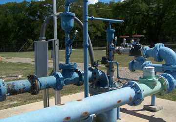
Across the state, water providers that traditionally relied on surface water are looking to groundwater because it’s seen as somewhat abundant, and it’s cheaper than other more technology-intensive options.
Imagine a city stretching from Waco to San Antonio, four miles wide on both sides of the interstate; that's where much of Texas' population growth is. Most of the surface water in this area is fully allocated. So, what's supporting this growth? Groundwater.
“Groundwater is important in Texas because it constitutes about 60 percent of the state’s water supply,” said Dr. Robert Mace, Texas Water Development Board (TWDB) deputy executive administrator for water science and conservation. “It also tends to be a drought-proof source of water, very affordable, distributed all over the state and good quality, not needing much treatment.”
According to the 2012 state water plan, groundwater supplies are projected to decrease 30 percent, from about 8 million acre-feet in 2010 to about 5.7 million acre-feet in 2060. This drop is primarily due to reduced supply from the depletion of the Ogallala Aquifer over time and reduced supply from the Gulf Coast Aquifer due to mandatory reductions in pumping to prevent land subsidence.
Many municipalities along the I-35 corridor are turning to groundwater, said Dr. Ronald Kaiser, professor and chair of the Texas A&M University Water Management and Hydrological Science Program.
“Imagine a city stretching from Waco to San Antonio, four miles wide on both sides of the interstate; that’s where much of Texas’ population growth is,” he said. “Most of the surface water in this area is fully allocated. So, what’s supporting this growth? Groundwater.”
Disputes over groundwater pumping in rural areas to support urban growth, Kaiser said, may be a growing issue facing Texas groundwater management.
“This is a real issue for San Antonio, the I-35 corridor, El Paso, Midland-Odessa and the areas west of I-35 where there’s very limited surface water to support the current influx of new growth, so it’s coming from groundwater, and those groundwater resources are in rural areas,” Kaiser said.
Changing methods for changing times
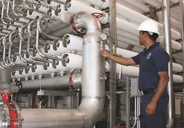
Some water-scarce regions are not only increasingly turning to groundwater, but also to relatively new-to-Texans technologies, such as aquifer storage and recovery (ASR) and desalination of brackish groundwater.
“ASR is used throughout the world,” Kaiser said. “Texas has been slow to adopt it because of cost and the availability of reservoir storage.”
By injecting excess water into aquifers and pulling it back out in times of need, ASR systems store water more efficiently than surface reservoirs, because evaporation is avoided. However, the initial costs involved in developing ASR and the newness of the technology here have prevented widespread adoption. There are currently successful ASR projects in San Antonio and Kerrville, as well as a plant in El Paso that uses similar techniques.
“ASR has great potential, and I think Texas will adopt more of it,” Kaiser said. “This will be driven by drought, scarcity of surface water and a need to develop reliability.
“Texas has not faced absolute necessity yet, when it comes to water. Those days are coming to an end, and soon we will be driven by necessity. It’s easier to build ASR when you have no other options, and once we reach that point, we’ll see plenty of ASR projects.”
“Oftentimes, with climate extremes, we have long-term droughts that are punctuated by extreme flooding,” said Dr. Bridget Scanlon, senior research scientist at The University of Texas at Austin’s Bureau of Economic Geology. “So, we have too much water when we don’t need it and not enough when we do. I think we need to come up with more ways to manage water and manage these extremes, and ASR is one way to do that.”
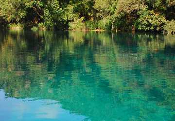
Desalination of brackish groundwater, which is saltier than freshwater but much less so than seawater, is also a growing area of interest for water providers.
“The good news is we have huge amounts of brackish groundwater, but the bad news is it’s going to be expensive to obtain and treat,” Kaiser said.
In addition to expense, water providers looking at possibly using these supplies also must consider the geological features of the aquifers they’re pumping from, Scanlon said, and where the freshwater and brackish water are found in the aquifer. Thick layers of low-permeability rock separate the two in some aquifers and ensure that brackish use wouldn’t affect the freshwater.
We’re mining water and removing it from some aquifers faster than nature is putting it in.
“It’s important to look at each aquifer’s geology and determine if or how brackish water supplies are connected to freshwater, so that you know how extracting brackish water might impact freshwater,” Scanlon said.
Aquifer depletion brings consequences
In addition to understanding geological characteristics, understanding the science of recharge — how, when, how fast and where aquifers fill up from rainfall — is critical to groundwater management.
“We’re mining water and removing it from some aquifers faster than nature is putting it in,” Kaiser said. “Because groundwater recharge is complicated, we don’t always know how much is really being replenished, but right now we do know that we’re pulling more water out than nature is putting in.”
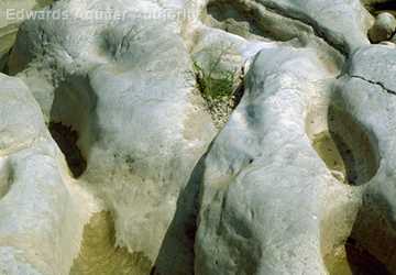
“Recharge is indeed complicated,” said Scanlon, who has extensively studied groundwater recharge in semi-arid climates, such as West Texas. Her research team measures chloride concentrations in groundwater to determine recharge, an extremely accurate method for semi-arid regions such as the Ogallala Aquifer region, but not for dynamic systems such as the Edwards Aquifer, she said.
“With aquifers that were recharged a long time ago, such as the Ogallala, we’re not dealing with responses to current conditions,” Scanlon said. “So, determining appropriate use can be difficult. Some people say we should just use less than the recharge, but in some places, like the High Plains, that would almost be zero water.”
Climate, land use and soil types are just some of the factors that influence groundwater recharge.
“Some regions of the Texas High Plains have Pullman clay loam soils, and there is almost no recharge through those soils because they are so tight, so fine-grained,” Scanlon said. “Even in times when those areas were flood-irrigated, the water didn’t go very deep. And the reason we know that is because we can track the nitrate from fertilizers that would move with the percolating water. We can look at that in the soil profile and see that it didn’t go deeper than 6 or 9 feet.”
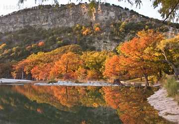
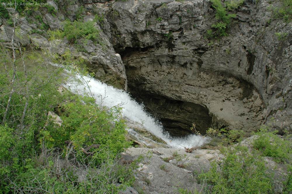
Measuring surface water is simpler; it’s somewhat easy to see when it rains how much water is in a river or stream. But for groundwater recharge, there are significant unknowns, Kaiser said. Different from other Texas aquifers because of its high permeability, the Edwards Aquifer is an exception and recharges relatively quickly, he said.
“The Edwards is so unique; most of our other aquifers have very, very slow recharge. If it rains in College Station, let’s say 40 inches, we may only get 2 inches of that infiltrating into the aquifer. Most of it will runoff or be used by vegetation and go through evapotranspiration.”
More complete and accurate groundwater quality data is a need that may soon see increased focus. According to the Texas Groundwater Protection Committee’s Report to the 83rd Legislature, “the need for enhanced groundwater data is obvious — there have been high-profile incidents where comprehensive groundwater quality data could have avoided unnecessary federal involvement, litigation and associated expenses for the state.”
The strategic importance of groundwater for global water and food security will probably intensify as more frequent and intense climate extremes, droughts and floods increase variability in precipitation, soil moisture and surface water.
TWDB recently added more than 80 years of groundwater-level measurements to its Water Data for Texas website. The board currently maintains 184 well recorders in 79 counties.
Data on how groundwater will be affected by climate extremes and climate change is another growing need, Scanlon said.
“The strategic importance of groundwater for global water and food security will probably intensify as more frequent and intense climate extremes, droughts and floods increase variability in precipitation, soil moisture and surface water,” she said.
The interdependence of groundwater and surface water deepens the consequences of aquifer depletion. Many rivers and streams in Texas are spring-fed, so increased pumping of groundwater will affect spring flows and consequently water bodies.
Groundwater management is no easy task
In Texas, surface water is legally considered public property and state-owned, while groundwater is considered private property — if it’s under your land, you own it. This approach to groundwater rights does not mirror the science involved, since hydrologically the two sources are connected. Most western states, with the exceptions of Arizona, California and Texas, manage surface water and groundwater conjunctively, Kaiser said.
Groundwater management in Texas is somewhat decentralized, with the 99 groundwater conservation districts around the state managing supplies — a role mandated by the Texas Legislature. Most aquifers include many districts, but there are some areas in Texas lacking any district.
Recent and pending court cases regarding groundwater add to the complexity. Some districts are waiting and watching lawsuit results before they determine appropriate future regulatory actions, Mace said.
Kaiser suggested that Texas should be moving to a regional approach to groundwater management. “A classic example of that is the Edwards Aquifer Authority, which has done an excellent job of bringing certainty to the water picture there.”
Kaiser said that there is a knowledge gap throughout Texas water discussions and average citizens alike when it comes to groundwater science.
“By and large, what Texans want is, when you turn the tap on, you want water to come out,” he said. “You don’t know where it came from, most of the time you don’t know how it was treated.
“It may take another decade or a continual drought in which a lot of wells run dry, but we will soon come to the realization that this current approach is not optimum. It’s a statewide problem, and it’s difficult for local units of government to solve basically a statewide problem.”