
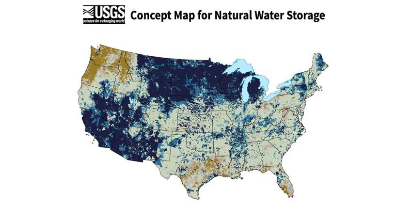
The National Integrated Water Availability Assessments concept map by the U.S. Geological Survey (USGS) shows the latest available daily estimate of natural water storage in the continental-United States relative to historical conditions, according to USGS.
The daily estimates are developed by collecting precipitation and temperature weather data for a complete day. The ‘natural water storage’ represented on the map includes water present on the landscape such as standing water and water on trees, snowpack, soil water and shallow groundwater, but does not include water in rivers or deep groundwater.
According to the website, this is the first iteration of the map, displaying a near real-time indicator of water availability with plans to include additional indicators of near real-time water availability (beyond natural water storage), as well as predictions of future water availability.
To view the estimated natural water storage for your region, view the map.