Tag: Transboundary Aquifer Assessment Program
-
Aquifers Along the Border
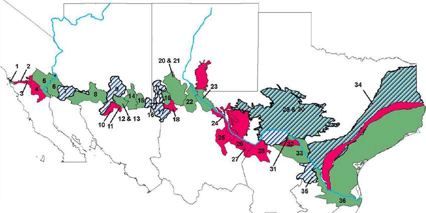
A complete count or map of the aquifers along the U.S.-Mexico border did not exist until 2023. Thanks to the leadership of Rosario Sanchez, Ph.D., Texas Water Resources Institute (TWRI) senior research scientist and TAAP lead, that map of all 72 shared borderland aquifers is now publicly available. (See map below.) Of those shared aquifers, 32 are…

-
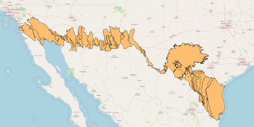
New U.S.-Mexico transboundary aquifer data included in 2021 Transboundary Aquifers of the World Map
Article originally written by Chantal Cough-Schulze The transboundary aquifers shared by the United States and Mexico are now included on the official global map of transboundary aquifers, thanks to new research by Texas Water Resources Institute (TWRI) senior research scientist Rosario Sanchez, Ph.D., and TWRI graduate research assistant Laura Rodriguez. The map, which is updated every five years,…
-
TWRI program spotlight: Our groundwater projects
For the month of March, we are spotlighting our groundwater programs, which include the Texas Well Owner Network (TWON), the Ogallala Aquifer Program (OAP), the Ogallala Water Coordinated Agricultural Project (Ogallala Water CAP) and the Transboundary Water Portal. Texas Well Owner Network Helping to protect Texas’ groundwater resources, TWON has Well Informed screenings and Well Educated training courses offered by the Texas A&M AgriLife Extension Service…
-
Researchers study shared groundwater resources between U.S., Mexico
Article originally written by Kathy Wythe Underneath the border of the United States and Mexico lie transboundary aquifers. Little is known about most of these aquifers or how the two countries can mutually manage these waters. Within Texas Water Resources Institute’s (TWRI) Water Sustainability Program, research scientists with TWRI and Texas A&M AgriLife Research are…