By Eva Vigh
Old timers say Magic Ridge Marsh in Magnolia Beach, Texas, used to be a great fishing spot. But for the past 50 years, it’s gotten harder and harder to land a bite.
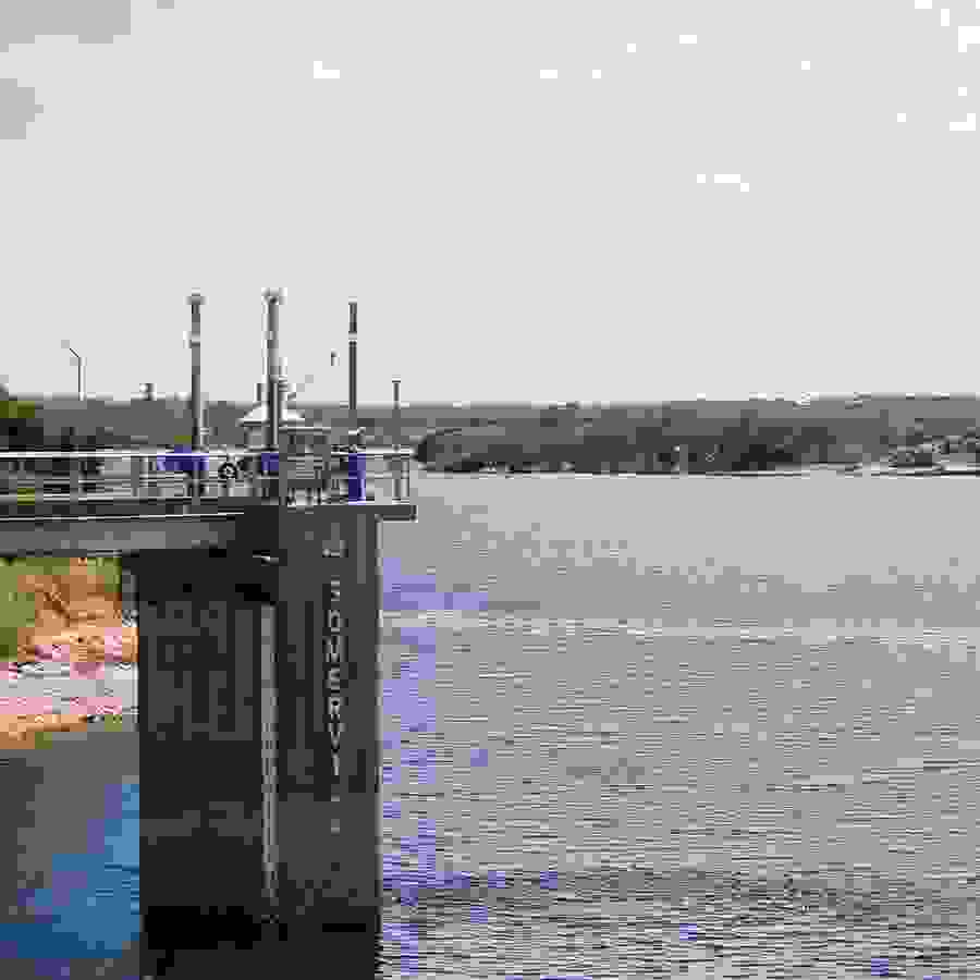
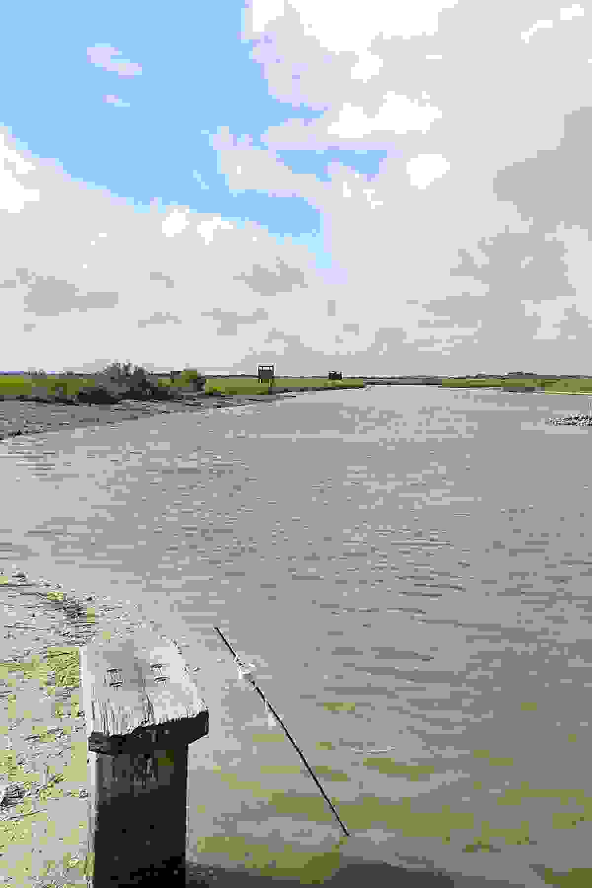
The saltwater marsh covers roughly 14 square miles, stretching from Magnolia Beach to Indianola in Calhoun County, and had been steadily degrading for years, experts said. Although the wetlands were historically connected to Matagorda Bay, blocked tidal flow at several points in the channel network caused large vegetative and ecosystem losses over time.
To restore tidal flow to the marsh complex, Dr. Rusty Feagin, coastal scientist in Texas A&M University’s Department of Ecosystem Science and Management, led work to remove the two primary barriers blocking the inlets.
The Texas A&M AgriLife Research Magnolia Beach to Indianola Marsh Restoration project, which began June 2013 and ended this year, was funded by a Texas Coastal Management Program grant and a Coastal Erosion Planning and Response Act grant from the Texas General Land Office, as well as a Hydrological Restoration grant from the National Oceanic and Atmospheric Administration and the Gulf of Mexico Sea Grant consortium. In 2016, it earned the state’s highest environmental honor, a Texas Environmental Excellence Award, from the Texas Commission on Environmental Quality.
Feagin and his team of AgriLife researchers determined both the northern, bigger inlet, which flows into west Matagorda Bay, and the southern, smaller inlet — the “back door” — were blocked by manmade barriers.
The barriers were remnants of berms and roads built by immigrants who landed on Magnolia Beach and migrated to Central Texas in the early 1800s, Feagin said. As they headed toward the Hill Country in their covered wagons, they built structures using shell hash, or tiny pieces of shells, to cross the marsh.
The additional buildup of oysters growing and dying on the structures further obstructed the inlets, and the barriers acted like small dams, he said, preventing water from flowing into the marsh. During the hot, dry months of summer, evaporation would increase and water levels would drop below the berms. As the water evaporated, salinity levels rose.
“The water leaves, but the salt stays, and it just gets more and more salty,” Feagin said. “Even if you bring more tidal water in and you block it up again, over time you’re just making it hypersaline.”
The team measured salinity levels of 160 parts per thousand (ppt) in some areas of the marsh, compared to Matagorda Bay’s 15 to 40 ppt levels.
“Some spots were more salty than the ocean,” he said. “But it should have been half the ocean strength.”
More than just physical barriers
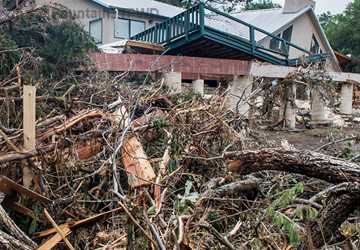
Years of blocked channels and stagnant, salty waters caused the marsh to degrade. Vegetation and aquatic organisms died, in part because of decreased oxygen levels and poor water quality, he said. Even when fish weren’t turning up dead in big kills, the once lucrative fishing habitat suffered. The community looked on as redfish, sea grass and other species disappeared.
“Everyone had been seeing this place go downhill,” Feagin said. “All the marshes were disappearing, and it was just turning into open water.”
After years of watching the land vanish and not acting to protect the marsh, the community was able to come together and address the marsh’s issues with the Texas A&M team’s help.
Everyone had been seeing this place go downhill. All the marshes were disappearing, and it was just turning into open water.
“Maybe they just didn’t want to talk, or they didn’t want to cross particular social barriers within the community, but we could step in and say ‘you need to do this,’” he said. “They saw us as a third party that wouldn’t have conflicting interests. We could put the pieces together to best serve everybody.”
Return of the tide
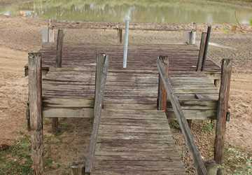
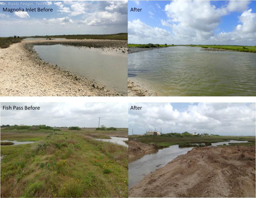
With the community’s support and guidance, the research team got to work. Working with several stakeholders, including private landowners and county officials, the team began groundwork to remove the two barriers. It first used a large backhoe to excavate the southern barrier and reopen the small flow into nearby canals and creeks. It was, as Feagin described it, like opening a small pet door and letting fresh air into a stagnant house.
Although water — and with it, aquatic life — immediately poured through the inlet, the flow was a trickle compared to what the salty marsh needed.
“You could see fish running through the channel, and tons of birds came as well. So it was doing something,” he said. “But when we really looked at all our salinity, water quality and vegetation measurements, we didn’t see a lot of change.”
It became clear the other barrier had to be removed to restore the marsh completely, Feagin said. In several days, the team dug out the northern barrier and dumped the sediment on the shoreline of a nearby lake, creating a submerged breakwater. This “artificial reef” will help protect the lakeshore from eroding and provide habitat for oysters, he said.
More than 100 truckloads later, the northern barrier was gone, the inlet was opened and tidal flows returned. The marsh was reborn.
Successful restoration
When Feagin stood at the marsh’s edge and gazed out at the landscape two days after removing the barrier, he was stunned at the transformation.
“Immediately you could see the water flowing,” he said. “It was really shocking because this place I had seen for a couple years; the water was always at the same level. But now that we took that barrier out, water could get out.”
The return of the water brought new plant growth and animals, including marsh grass and red fish.
Because marsh grass grows at the waterline, Feagin said as the marsh tide goes out further with the increased water, plant growth is already expanding and covering quite a bit more land.
“Now that the waterline is out, the grass is migrating out, and we are gaining a ton of marsh,” he said. “We’ll get back a lot of the marsh we lost in the last 50 years.”
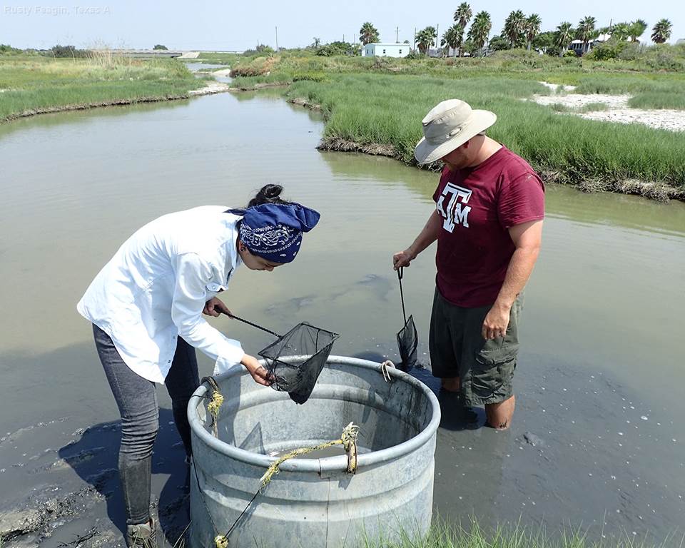
Post-restoration water quality samples are indicative of success as well.
“We have water level gauges all over the marsh in different places, and salinity has dropped,” Feagin said. “Our water level data confirms what you see with your eyes.”
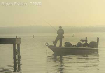
To test further its restoration efforts, the team drove along the marsh shoreline, rolled down its vehicle’s windows and asked the fishermen if they were getting any bites — but the answer was already obvious. Feagin said he could see the anglers, backs to the sun, filleting dozens and dozens of red fish.
The project’s success helped set the standard for future restoration projects, Feagin said. Simply removing the barriers, rather than attempting to build more marshland, was a very economical approach, he said. “Now the Texas General Land Office wants to fund hydrological restoration-type projects, as they’re so cost effective.”
Although the project is completed, Feagin said future testing could be done to assess the long-term results and success of the restoration efforts.
“You find a place that is dying or dead, go to one spot on that landscape and do something relatively simple, and you can fix the whole thing. So that’s what we did.”