
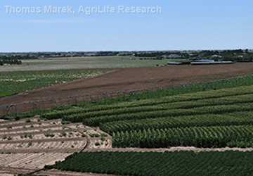
Back in the early 20th century, before groundwater wells were drilled, before center pivot irrigation was used and before modern urban development, much of the High Plains region in central United States was rolling sand dunes covered with native grasses. The agricultural industry consisted mostly of grazing cattle and dryland crop production.
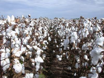
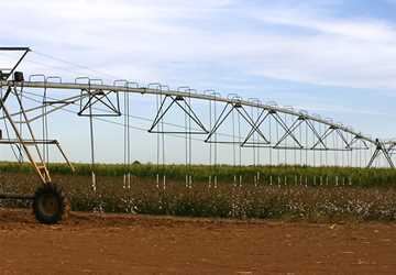
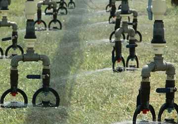
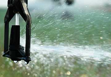
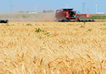
In the ensuing years, developments in groundwater pumping and irrigation technology allowed water from the Ogallala Aquifer, which lies beneath much of the High Plains, to be used to irrigate crops, changing the appearance and economy of the area. It became known as “the bread basket of America” with fields of irrigated wheat, corn and cotton and a robust agricultural-based economy.
Today, the High Plains region provides about 30 percent of all U.S. crop and livestock production, according to the U.S. Department of Agriculture (USDA), with about 40 percent of jobs in the High Plains directly or indirectly tied to agriculture. Irrigation accounts for more than 90 percent of groundwater withdrawals from the Ogallala Aquifer with withdrawals exceeding recharge rates in most areas.
As water levels in the Ogallala Aquifer continue to decline, reducing producers’ ability to irrigate crops, what will happen to this robust economy and the agricultural industries the nation depends on so much?
As water levels in the Ogallala Aquifer continue to decline, reducing producers’ ability to irrigate crops, researchers from two USDA-funded Ogallala Aquifer projects are trying to understand the current economy and the agricultural industries to help predict the economic future of this nationally important region.
More information
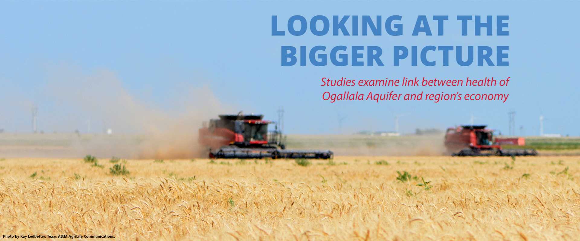
Looking at the bigger picture
Studies examine link between health of Ogallala Aquifer and region’s economy, associate professor at Colorado State University (CSU) and a member of the Ogallala Water Coordinated Agriculture Project (Ogallala Water CAP), said a large portion of the Ogallala Aquifer region — particularly in the southern and western part — doesn’t have access to surface water and has little precipitation coupled with high temperatureDr. Jordan Suter, associate professor at Colorado State University (CSU) and a member of the Ogallala Water Coordinated Agriculture Project (Ogallala Water CAP), said a large portion of the Ogallala Aquifer region — particularly in the southern and western part — doesn’t have access to surface water and has little precipitation coupled with high temperatures.“In those particular areas, the Ogallala provides an input that is critical to maintaining the agricultural economy that exists there today,” he said. “There is no substitute.”
Many are asking this question, in particular researchers from two USDA-funded Ogallala Aquifer projects. They are trying to understand the current picture to help predict the economic future of this nationally important region.
Dr. Jordan Suter, associate professor at Colorado State University (CSU) and a member of the Ogallala Water Coordinated Agriculture Project (Ogallala Water CAP), said a large portion of the Ogallala Aquifer region — particularly in the southern and western part — doesn’t have access to surface water and has little precipitation coupled with high temperatures.
“In those particular areas, the Ogallala provides an input that is critical to maintaining the agricultural economy that exists there today,” he said. “There is no substitute.”
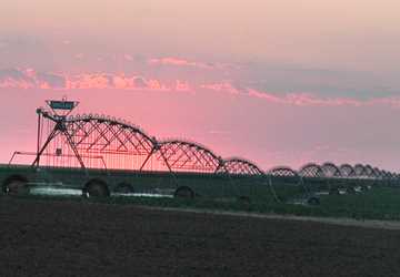
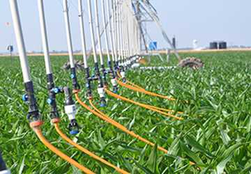
Already producers are making changes — switching crops, adding livestock and implementing more efficient water conservation technologies. Likewise, groundwater management districts are implementing pumping limits.
Looking at the bigger picture
Dr. Bridget Guerrero, assistant professor at West Texas A&M University, said when examining the link between the sustainability of the Ogallala Aquifer and the economic health of the High Plains region, one has to look at the bigger picture.
“When you look at overall agriculture in the High Plains region and you think about the economy, it’s not just about producers or those businesses that have that agricultural label,” said Guerrero, who is a researcher with the Ogallala Water CAP and the Ogallala Aquifer Program (OAP). “It is also the banking industry. It’s where farmers spend their money, where they shop for cars and shop for groceries.
“It really becomes a more complex problem when you think about all the individual businesses that are touched or impacted by agriculture,” she said.
When you look at overall agriculture in the High Plains region and you think about the economy, it’s not just about producers or those businesses that have that agricultural label. It is also the banking industry. It’s where farmers spend their money, where they shop for cars and shop for groceries.
Dr. Bridget GuerreroAs part of the OAP, Guerrero co-authored a series of six publications with Dr. Steve Amosson, a recently retired Texas A&M AgriLife Extension Service economist, and others. They evaluated the economic impacts of different agricultural industries as well as the industries’ impact on water use in the southern Ogallala region.
“As the region’s leaders consider water conservation strategies to prolong the life of the aquifer, they will need to evaluate the water use and economic impacts given the water use of each of the different industries,” she said.
The group analyzed the cotton, beef, dairy, swine, feed grains and small grains industries, using the computer analysis program, IMPLAN (IMpact analysis for PLANning), which estimates direct, indirect and induced effects.
“If you are talking about water conservation with agriculture being the biggest water user, you need to look at agriculture from every standpoint,” Guerrero said. “Yes, agriculture is a big water user, but it is a main economic driver also.”
In the publications, she said they evaluated the different agricultural sectors in terms of dollars generated per acre-foot of water used. Confined animal feeding operations (CAFOs), which includes beef, dairy and swine, have the highest value, creating more jobs and generating more dollars overall compared to crop production.
“However, all the agricultural sectors of the economy are interrelated and crop production is an important input into CAFOs, especially dairies that rely on locally grown silage,” she said.
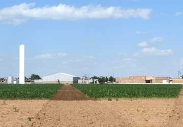
Dr. Bill Golden, research assistant professor at Kansas State University, also works on the two Ogallala Aquifer projects. He agreed that although feedlots, dairies and meatpacking plants all contribute significantly to the economy in the Southern High Plains, crops are still important commodities.
“Crops are normally considered low-value water users and generate fewer dollars per acre-foot, but that doesn’t mean that producers should quit using water for crop production,” he said. “We need to be growing irrigated crops, but we need to make sure we are using the water for irrigated production as efficiently as we can use it.”
Studying groundwater conservation practices
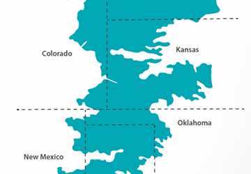
Eight states share the water in the Ogallala Aquifer: Colorado, Kansas, Nebraska, New Mexico, Oklahoma, South Dakota, Texas and Wyoming, and each state has its own methods to deal with groundwater. Ogallala Aquifer researchers are studying alternative ways to manage it to save water.
For example, Kansas is exploring local enhanced management areas, or LEMAs, as a way to reduce groundwater consumption and extend the life of the Ogallala. In a simple explanation, Golden said producers voluntarily get together and discuss ways to reduce water use, coming up with a groundwater conservation plan. The groundwater management district then submits the plan to the state’s chief engineer, who reviews and approves the plan. Once approved by the chief engineer, the LEMA plan becomes law, effectively modifying prior appropriation regulations, also known as the “first in time, first in right” doctrine.
Golden said research results suggested that the LEMA framework will provide benefits to both agricultural producers and rural communities. There are two LEMAs in Kansas to date, and producers within these areas have reduced water use while maintaining their profits and yield. However, Golden cautioned, using LEMAs as a water conservation policy may only result in short-lived reductions in groundwater consumption with water saved today eventually being used by someone else.
“Even with rather severe reductions in groundwater use today, some areas will remain over-appropriated and water saved today will eventually be used and the water resource exhausted,” he said.
In Colorado, Suter along with other researchers at CSU developed a hydroeconomic model to help understand how the profitability of agriculture would change over time as the aquifer levels change. Their research focused on the Republican River Basin in Colorado, which is over the western part of the Ogallala Aquifer.
“Formulating the hydroeconomic model is challenging because it involves linking economic decisions about what crops get planted and how much water is applied to those crops with the hydrology of the aquifer itself and how it responds to changes in water use,” Suter said. “It is a pretty novel framework that we have set up and can be used to try to predict longer-term outcomes.”
He said the research team was able to generate a baseline scenario looking at 50 years in the future and determine how profits of producers can be expected to change at different areas within the basin by implementing various conservation strategies, such as restricting the amount of pumping during a season or charging a pumping fee. They found that some producers would not see much decline in their profits while producers in other areas would see a decline because of having limited water.
“Even with rather severe reductions in groundwater use today, some areas will remain over-appropriated and water saved today will eventually be used and the water resource exhausted."
While recognizing the results are based on a model, Suter said their research provides numerical outcomes that are better than pure speculation, which he hopes allows the different management districts to weigh the costs and benefits of various groundwater conservation strategies.
“The Ogallala Aquifer is large and shared; there is a lot of variation in the amount of water available at any one point on the map,” he said. “Some areas are going to feel the pinch more than others, and we were able to highlight that in some of our modeling results.”
Suter said the model provides a “menu of sorts.”
“We are not trying to give specific recommendations on exactly what policies should be implemented, but rather say, ‘Here are the tradeoffs that you face and here are the outcomes for the various policy scenarios that could be implemented,’” he said.
Although Suter’s work was focused on the Republican River Basin, he said the basin somewhat mirrors the entire Ogallala Aquifer region and the challenges of producers in the basin are similar to what producers in Texas and parts of Kansas are experiencing.
The CSU researchers coupled with other researchers in the Ogallala Water CAP are generating similar types of models for Texas, Oklahoma, Kansas and Nebraska to better illustrate the variety of outcomes that could occur throughout the Ogallala Aquifer region.
Future economic picture
In the agricultural industry publications, Guerrero said they considered the future growth of agriculture in the southern Ogallala Aquifer region. “What we envision for this region is that we are going to have this transition from irrigated to dryland crop production,” she said.
CAFOs also have room for growth in the future, especially feedlots.
“If the fed beef industry experiences growth, it wouldn’t be hard to import the grain from other regions to support their input needs,” she said.
The region is grain deficit and is already importing about 35 percent of feed grain demand.
“We need to make sure all those industries survive, so we need to use water as frugally as we can,” Golden said. “If we continue the way we are today, there will be less irrigated crop production in 40 years than there is today.”
The Ogallala Aquifer is large and shared; there is a lot of variation in the amount of water available at any one point on the map. Some areas are going to feel the pinch more than others, and we were able to highlight that in some of our modeling results.
Golden said since the aquifer isn’t uniform — some areas, such as areas in southwest Kansas, have 200 years of water left; others, such as other localized areas in west-central Kansas, have 10 years left — the change to less irrigated crop production will be a gradual process. Kansas already has thousands of acres that are no longer irrigated, and producers are trying to convert back to dryland or re-establish native grasses.
Guerrero said commodity groups and stakeholders are considering the best strategies producers can implement when their available water is reduced or restricted to keep their operations viable.
“We are really trying to look at ways to keep producers as profitable as possible when they are facing these limits with water,” she said.
Explore this Issue
Authors

As the former communications manager for TWRI, Kathy Wythe provided leadership for the institute's communications, including a magazine, newsletters, brochures, social media, media relations and special projects.