
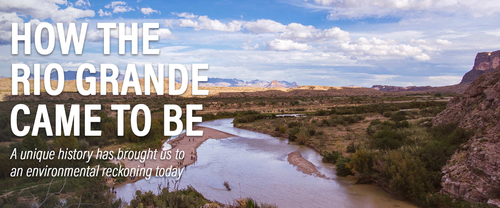
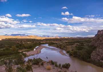
From where the Rio Grande springs forth in Colorado’s San Juan Mountains to where it empties into the Gulf of Mexico, the river supports an ever-growing population, vital agriculture and vast ecosystems today. But the present is rooted in the past, and the history of the river and the laws surrounding it shaped today the same way the river literally shaped the countries that border it.
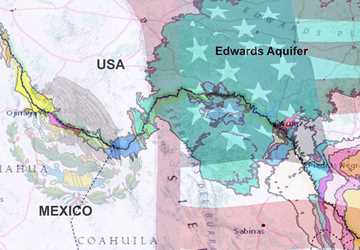
Roughly two-thirds of the Rio Grande’s length and 50,000 square miles of its watershed can be found in what today is known as Texas. In the often-dry landscape of South and West Texas, the use, management and value of the Rio Grande’s water has long been a hot topic in Texas, said Carlos Rubinstein, former chairman of the Texas Water Development Board and former commissioner and Rio Grande Watermaster for the Texas Commission on Environmental Quality.
“You can’t talk about Texas water history without starting with the Rio Grande. You just can’t,” Rubinstein said.
From the ground up
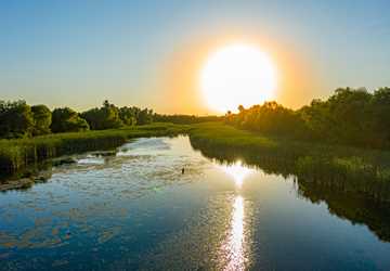
The Rio Grande Valley isn’t really a valley.
The history of the Rio Grande starts with what’s under your feet, said Jude Benavides, Ph.D., associate professor in the University of Texas Rio Grande Valley’s School of Earth, Environmental and Marine Sciences. What’s underfoot in the Rio Grande Valley — the area along the southernmost part of the river — is misnamed. The Rio Grande Valley is actually a delta.
Being called the wrong name is significant, Benavides said. It means people know less about where they are, how to identify with the land and how history has shaped that land.
“It sounds like playing semantics, but it’s a big deal if you don’t know exactly what the land is, how your region was created, how the very soil that farmers rely on was created,” he said.
Understanding the Rio Grande, as well as the people, ecosystems and economies along it, requires looking back — way back.
“All history starts with geologic history,” said Jaime Flores, Texas A&M AgriLife Extension program coordinator at the Texas Water Resources Institute. “You have to start there to get to the point where it was the 1900s and they were going to start developing this area.”
Thirty-five million years ago, the formation of the Rio Grande began, jumpstarting a region that would become home to millions of people. The past hundred years of land changing hands, water management and infrastructure development have created the Rio Grande we know today. Experts say what comes next is an environmental reckoning.
Estimated reading time: 14 minutes
More Information
- Pesos and Dollars: Entrepreneurs in the Texas-Mexico Borderlands, 1880-1940
- Inventing the “Magic Valley” of South Texas, 1905–1941
- The 1906 Convention
- The 1944 Treaty
- Texas Watermaster Program
- Just One Shared River: the Future of Water Deliveries on the Rio Grande
Want to get txH20 delivered right to your inbox? Click to subscribe.
About 140 million years ago, much of what would become Texas was under a vast shallow sea. The remains of marine organisms formed limestone rocks that are still visible around Texas. Dinosaurs roamed the region; just over 65 million years ago, the world’s largest known flying creature, Quetzalcoatlus, soared over Big Bend.
The Earth’s crust began to stretch and thin in southern Colorado and New Mexico some 36 million years ago, triggering volcanoes and eventually creating a rift. Over the next 35 million years or so, streams followed the rift and coalesced into the ancestral Rio Grande, gradually pushing toward the Gulf of Mexico. The river finally reached the Gulf less than 2 million years ago, depositing fertile soils and creating the delta now known as the Rio Grande Valley.
It sounds like playing semantics, but it’s a big deal if you don’t know exactly what the land is, how your region was created, how the very soil that farmers rely on was created.
Jude Benavides, Ph.D.Peopling the Rio Grande
By 11,500 years ago, hunter-gatherers were living in the Rio Grande region. Over the next thousands of years, inhabitants would leave behind shell ornaments and spear points, as well as beads possibly traded from Mesoamerican people.
A number of Native American tribes, including the Coahuiltecans, Jumanos, Apache and Pueblo peoples, lived near the Rio Grande when Spanish conquistadors first arrived in Texas in 1519. By the 1750s, the Spanish had colonized the Rio Grande and begun dividing the land into tracts for cattle ranching.
Mexico, including what is now known as Texas, won independence from Spain in 1821. In quick succession over the next 50 years, Texas went from being part of Mexico to being an independent nation, a U.S. state, a Confederate state and a U.S. state again.
After the Mexican-American War — during Texas’ first round of being a U.S. state — the 1848 Treaty of Guadalupe-Hidalgo established the Rio Grande as the border between the United States and Mexico. People living along some parts of the river woke up as part of a different country. Though many people on the river’s northern bank stayed and became U.S. citizens, the region remained predominantly culturally Mexican, and on the 1887 Texas state census, most people living in the area identified as “Mexican.”
Taking and creating the Magic Valley
In the late 1800s and early 1900s, the landscape of the Rio Grande began to change. Intense droughts resulted in the deaths of thousands of cattle. To survive, many Tejanos — Texans of Mexican descent — had to sell their remaining livestock and the land that had been in their family for generations.
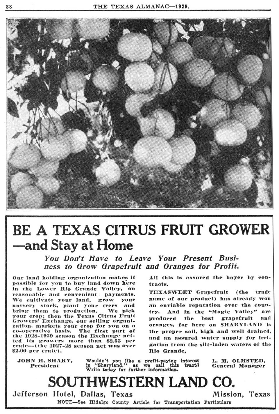
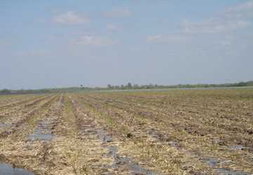
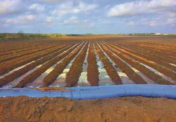
Land developers descended on the area in the early 1900s, seeing an opportunity to expand agriculture by capitalizing on irrigation and the region’s mild winters, said Wayne Halbert, former general manager for the Harlingen Irrigation District.
“The river is the highest place in the delta, so the land developers determined that if they could just get the water out of the river, that it would flow for miles north and east,” he said. “So they brought the steam engines in and set them up on the river and began to build waterways to develop that land.”
Some land was purchased, often for far below market value. Thanks to readily available water, land prices had shot up from $0.25 per acre to $300 per acre between 1903 and 1910, roughly equivalent to increasing from $7.60 per acre to $8,200 per acre in today’s dollars. Property taxes went up as well. The land of cash-poor, land-rich Tejano landowners was often foreclosed on, and the valuable land was sold for nothing but the tax arrears.
Other times, incoming land developers and ranchers resorted “to the simple expedient of occupying a desired tract and violently expelling previous occupants,” wrote Benjamin Heber Johnson, Ph.D., in his book, “Revolution in Texas: How a Forgotten Rebellion and Its Bloody Suppression Turned Mexicans Into Americans.”
All the while, the land developers began marketing the lower Rio Grande region as the “Magic Valley.”
Incoming land developers and ranchers resorted “to the simple expedient of occupying a desired tract and violently expelling previous occupants."
“I guess the ‘Magic Valley’ sounded more appealing in advertisements than a delta,” Halbert said.
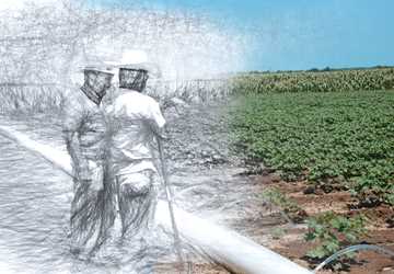
Railroad advertisements described an abundant tropical farming paradise where irrigation water was plentiful and citrus groves popped up with little help. Labor — mostly from the same Tejanos who the land developers had bought, swindled or stolen the land from — was said to be readily available.
C.H. Swallow, a land developer, made a song book to encourage the “Magic Valley” mythos. Despite the region’s periodic droughts, one song’s lyrics included: “This valley cares not for the rain / No [drought] can ever mar its name / By telephone the water comes / To grow our crops and build our home.”
Whether or not the advertisements were all true, the allure of good land drew hopeful farmers from all over to the “Magic Valley,” said Halbert.
“The land developers had land drives; they went up north and brought thousands of people down who were interested in moving to the ‘tropical Rio Grande Valley’ and start farming,” he said.
“Lots of folks came from as far as Ohio, Illinois, Nebraska and all of that farm country up there. Many of those places were going through drought issues, and of course, they were limited because they couldn’t farm during the wintertime. So there was a huge incentive for those people to come down.”
Setting ground rules
In 1910 and 1917, more droughts devastated parts of Texas.
“Texas always responds to droughts. Each drought resulted in a different set of legislation,” Rubinstein said.
Those droughts led to a landmark Texas constitutional amendment stating that conservation of the state’s natural resources, including water, were “public rights and duties.”
“Without the amendment, we couldn’t have river authorities, the Texas Water Development Board or the Texas Commission on Environmental Quality. If you’re going to make a list of laws that have had the greatest impact statewide for water management, you have to start with that amendment,” Rubinstein said.
The amendment also helped strengthen irrigation districts, which had begun forming several years earlier when land developers had gone bankrupt from trying to provide farmers with enough water. The irrigation districts are governed by an elected board of directors made up of district landowners, who in turn select a general manager to manage the district. Unlike the land developers, the irrigation districts could tax themselves to be able to continue providing water.
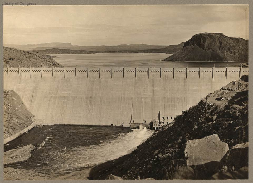
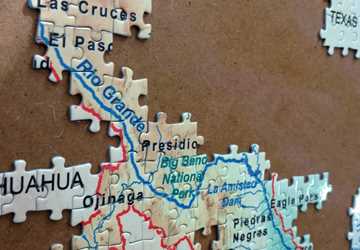
The creation of irrigation districts was one step in a stream of changes to the Rio Grande’s management. In 1906, the United States and Mexico held a convention leading to the creation of Elephant Butte Dam, which allowed for capturing and delivering set amounts of water to Mexico, New Mexico and Texas. But the convention only governed water use as far as Fort Quitman, hundreds of miles upstream from the Gulf of Mexico.
“The rest said, ‘What about us? What’s going to govern our use?’ The folks in the Rio Grande Valley were promised another treaty, and they waited,” Rubinstein said.
After the wait
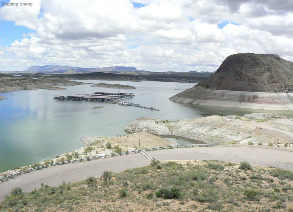
Nearly 40 years later, Mexico and the United States created the 1944 Treaty for the Utilization of Waters of the Colorado and Tijuana Rivers and of the Rio Grande, commonly called the 1944 Treaty. The treaty addressed how to divide and distribute the remaining water, as well as authorizing two international dams, Falcon and Amistad, which would be constructed over the next 30 years.
When Falcon Dam was finished in 1954, water management swiftly got more complicated. Thanks to a tropical storm, Falcon Reservoir filled to the brim in a month, rather than the expected seven years.
“Everybody thought that’s it; our problems are over. And they weren’t, of course. Two years later the lake was largely empty,” Rubinstein said.
“But there was still some water left. The city of Brownsville ordered water out of Falcon Reservoir. The water was released, and a small irrigation district in Hidalgo County saw it flow by and picked up the water instead. The river went dry, and there was a court case.”
That case is commonly called the 1969 Valley Water Case and, together with the subsequent Water Rights Adjudication Act, changed everything about how water rights were handled in Texas.
Halbert explained that the case took on the arduous task of sorting through historical use claims from water rights holders. It took seven years to fully adjudicate. The case also established the Texas Watermaster Program, which allowed water to be released according to different irrigation districts’ water allocations.
“It’s just like a bank account; you’re only allowed however much your percentage is of the water that’s behind Amistad and Falcon dams,” Halbert said. “Just like you can only write a check for how much money you’ve got in your bank account, you can only order that much more water.”
The watermaster manages everyone’s water bank account, ensuring everyone gets the amount they need from their total amount when they need it.
“There’s a schedule of how long it takes for water to leave Falcon Reservoir and arrive at a certain locality on the river,” Halbert said. “For the Harlingen Irrigation District, for instance, it’s four days. So the irrigation district calls the watermaster and says four days from now, and for five days, we’re going to be pumping 300 cubic feet per second out of the Rio Grande.”
The Watermaster Program is like a bank account ... Just like you can only write a check for how much money you’ve got in your bank account, you can only order that much more water.
The watermaster then combines every irrigation district’s water requests and releases the water, which is depleted in each district as it moves downstream.
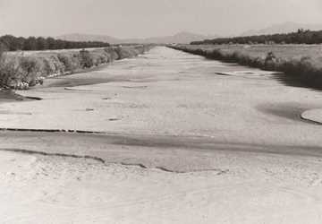
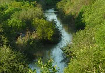
An environmental reckoning
The Rio Grande region’s population has continued to grow in the years since the Valley Water Case. Despite all the regulations, Rubinstein said it has become obvious that one vital element had been left out of the equation.
“We allocated all the water, but we never reserved water for the environment,” he said.
Over the past 25 years, there have been a few Texas Senate bills that address the lack of water left for the environment, but in Rubinstein’s perspective, none of them have been enough. Without leaving water for the environment, the Rio Grande — and the resources and services it provides — is dwindling.
“The fallout of that is that during drought conditions, the environment is the first to be impacted,” he said. “The ecosystems of our rivers and streams bring great economic value to Texas, and not recognizing those impacts will have long-term implications on fish production, healthy ecosystems, biodiversity, water quality and on and on.”
It all comes back to — how are we going to properly value water?
Carlos RubinsteinAccording to Rubinstein, the next steps in the history of the Rio Grande’s water — and all of Texas’ water — will be to set aside water for the environment, support farmers and ensure that existing treaties are adhered to.
“It’s all of that, and no one of them come first,” he said. “It all comes back to — how are we going to properly value water?”
“If you don’t know what your water is worth other than what it’s worth from the crops you’re going to grow, then it’s a use-it-or-lose-it proposition. If you know what your water is really worth, then you can put it up to the market at its proper value to see if somebody else can put it to a higher and better use. That could mean meeting somebody’s municipal demands or a forbearance agreement to meet environmental flows.”
With the population along the Rio Grande continuing to grow and more droughts on the horizon, Rubinstein said that talking about the history of water won’t be enough. More policy and action will be necessary.
“It’s easy to talk about but very hard to do,” Rubinstein said. “But if you don’t value water, then you’re not protecting water.”
Explore this Issue
Authors

As a communications specialist for Texas Water Resources Institute, Chantal Cough-Schulze worked with the institute’s communications team writing articles for and editing txH2O magazine and TWRI's news section, developing TWRI multimedia materials and editing reports and education and outreach materials. She also served as the managing editor for the Texas Water Journal.