
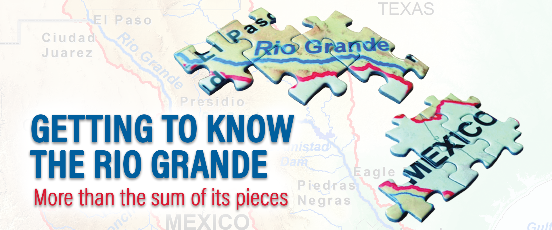
You may think you know the Rio Grande — or perhaps you know it as the Rio Bravo as it is commonly called in Mexico. But you probably only know a small piece of the overall picture. It is one river but, in many ways, it is so much more.
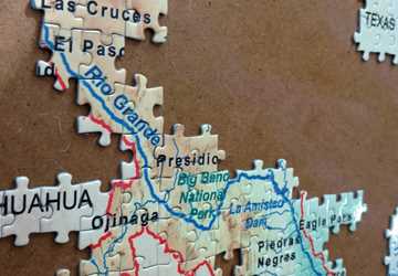
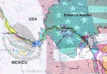
The Rio Grande/Rio Bravo is one of the longest rivers in North America, running about 1,900 miles from its headwaters in the San Juan Mountains in southern Colorado to where it meets the sea in the Gulf of Mexico. Its total watershed covers about 336,000 square miles across two countries, three U.S. states and four Mexican states.
But more than the tangible details, the river is the stuff of legends and the backbone of life in an arid region. It is the lifeblood to agriculture and the wider economy of booming metropolitan areas. It is the force that literally shaped the U.S. and Mexico and helps define those countries as they are known today.
However, the river is not what it once was.
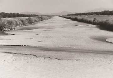
“The Rio Grande is not grand. It was, but it’s not anymore,” said Rosario Sanchez, Ph.D., Texas A&M AgriLife Research senior research scientist at the Texas Water Resources Institute (TWRI) and director of the Permanent Forum of Binational Waters (PFBW).
Samuel Sandoval Solis, Ph.D., associate professor in the Department of Land, Air and Water Resources at the University of California, Davis, spoke of the river in familiar terms as an old friend who has fallen on hard times lately.
“If you would have known him in his good years, he was a very strong, resourceful person, but as time has passed, he has gotten very sick,” said Sandoval, who is also a Cooperative Extension specialist in water management and part of the executive committee for PFBW.
Estimated reading time: 13 minutes
The Rio Grande/Rio Bravo is so many things to so many people: the border between countries, the economic lifeblood of a desert and an old friend. But it is more than the sum of its parts, and we risk our future by trying to look at individual pieces rather than the whole picture.
More Information
- The Rio Grande Water project
- IBWC’s Rio Grande page
Want to get txH20 delivered right to your inbox? Click to subscribe.
Sandoval is not alone in describing the river as unwell. Several U.S. and international nonprofit groups including American Rivers, the World Wildlife Fund and the World Resources Institute place the Rio Grande on “endangered river” lists due in large part to high levels of water stress in the region. The river’s water is overallocated, with its flow frequently low to nonexistent in places. For example, 2001 was the first time in a half century that the river stopped flowing to the Gulf of Mexico. Additionally, the river’s water quality is hampered by excessive bacteria and high salinity.
The river’s ailments have been attributed to its extensively controlled nature, ever-increasing demands on its water and climate change. However, experts also said the problems lie in how we think about the river, as parts rather than a whole picture.
“We don’t see and we don’t think of the river as a whole natural, socio-economic system, and we haven’t managed it as one,” said Luzma Fabiola Nava, Ph.D., researcher for Mexico’s National Council for Science and Technology (Consejo Nacional de Ciencia y Tecnología) and member of the PFBW advisory committee.
“We have managed water for different users and for different purposes, and then, more recently, as the border that we need to control and secure,” Nava said. “When we think about the river, it’s a set of different pieces of different sizes or different characteristics.”
Sanchez said this approach is understandable given how big and complex the river, its basin and the issues surrounding it are.
“But the river doesn’t understand that,” she said. “Whatever we do will impact the entire river up and down stream and people both north and south of the border.”
A river in pieces: A force to be tamed
The segmented way people think about the river can be seen in the very fact it has two names, said Jude Benavides, Ph.D., associate professor in the School of Earth, Environmental, and Marine Sciences at the University of Texas Rio Grande Valley.
“When you’re getting to the point where you even have different names for the system, you can see how easy it is to have disconnects when thinking about it and approaching it.”
He also said both the names and the river itself can surprise people — for good or bad — depending on what they expected.
“People misconstrue the name Rio Grande, meaning big, or Rio Bravo, meaning brave or fierce. And when you say ‘river,’ people envision a flowing waterway with a lot of water in it,” he explained.
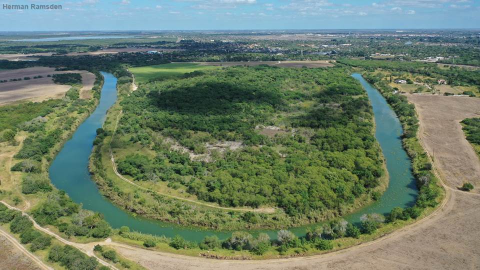
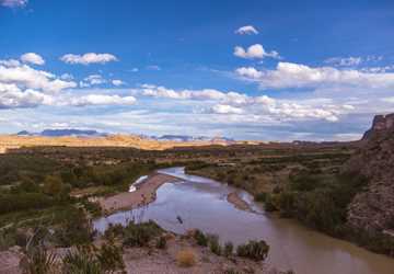
Here in Texas, the Rio Grande has always been mythical, like folklore. Before it was dammed, it was a very powerful river, and it would flood every year. When the river wakes up — when it becomes the Rio Bravo again — it’s still a sight to see. It will still destroy anything it wants to.
“Yes, it’s a long river, but it is not a big river in the sense of overall annual flow. We had to break the back of this once brave river and tame it for our benefit,” Benavides said. “When they tamed it, it changed.”
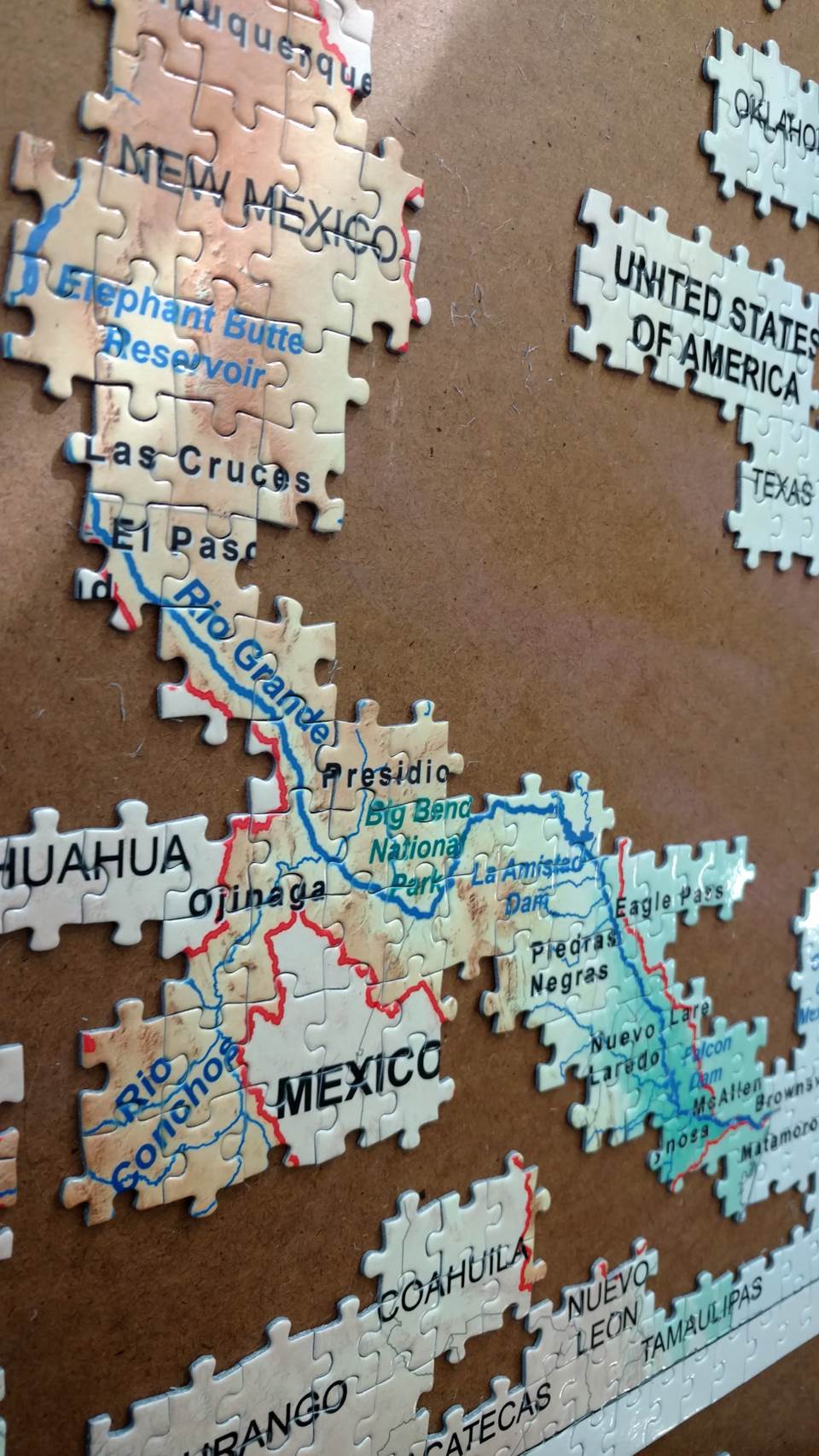
The river has been called one of the most engineered rivers in the world. According to the U.S. Bureau of Reclamation, there are dozens of dams; hundreds if not thousands of miles of canals, laterals and drains; two major international reservoirs; and several hydroelectric powerplants constructed along the river’s length. Construction of existing structures on the river began in 1906 with the modest Leasburg Diversion Dam in New Mexico, but this was quickly followed by the massive Elephant Butte Reservoir in 1916. Such infrastructure allowed the area to become a veritable garden of agricultural bounty through irrigation and allowed people — by the millions — to settle in the region without the threat of regular cataclysmic floods.
Still, Benavides says he prefers the Mexican nomenclature because it conjures up images of a river that can wake up and be a destructive, powerful force again under the right conditions. It is not just sentiment that draws him and others to this element of the river.
“I think that name ‘Rio Bravo’ better sums up the hydrology of the river than the name ‘Rio Grande.’ You’ve got a river that is primarily what we call ephemeral or flashy,” Benavides said.
Jaime Flores, Texas A&M AgriLife Extension program coordinator at TWRI and watershed coordinator for the Arroyo Colorado Watershed Partnership, shared this perspective.
“Here in Texas, the Rio Grande has always been mythical, like folklore. Before it was dammed, it was a very powerful river, and it would flood every year. When the river wakes up — when it becomes the Rio Bravo again — it’s still a sight to see. It will still destroy anything it wants to.”
Flores explained that the last time the river “woke up” in a big way was during Hurricane Alex in July 2010, which saw the worst flooding in decades. Hundreds of homeless families and over $100 million in damages to crops, property and infrastructure were left in the floodwaters’ wake.
“It was kind of a reminder of the way the river used to flow. It also showed how, through modern technology, we’ve been able to tame it in a sense,” Flores said. “We can at least guide it without it destroying everything. But if one of those levies had failed up in Mission, it would have wiped out the entire Rio Grande Valley.”
A river in pieces: A resource to be used
The river is an intimate part of an ever-growing number of lives. Currently, an estimated 12-13 million people on both sides of the border depend upon the Rio Grande/Rio Bravo for their water, according to the International Boundary and Water Commission (IBWC).
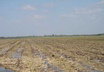
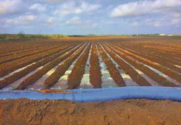
Agriculture also needs the river. An estimated 1.8 million acres of crop and pastureland was irrigated with the river’s waters in 2006, according to the IBWC. According to the U.S. Census of Agriculture’s 2018 Irrigation and Water Management Survey, roughly 710,000 acres in the U.S. were irrigated in the Rio Grande Water Resources Region, supplying billions of dollars worth of agricultural goods to the Texas and U.S. economies. Those agricultural goods — including pecans, citrus, beef, sugar and cotton from Texas alone — go on to feed and clothe untold numbers of people in the U.S., Mexico and around the world. Though exact numbers are harder to come by for Mexico, the cultivation of cash crops in Mexico has grown in recent years, creating yet more demands on the water.
A lot of people would tell you climate change is the biggest threat, but there’s a reason that you need the water; there’s a growing demand for it.
“I think population honestly trumps all the other issues simply because there are so many more straws in the bucket now than there were back in the day,” said Lucas Gregory, Ph.D., AgriLife Research assistant director of TWRI, referencing the history of water disbursement along the river. Though management of water distribution from the river started far earlier, what is now often called the 1944 Treaty governs water allocations between the U.S. and Mexico along several rivers, including the Rio Grande/Rio Bravo.
Allen Berthold, Ph.D., AgriLife Research assistant director of TWRI, agreed.
“A lot of people would tell you climate change is the biggest threat, but there’s a reason that you need the water; there’s a growing demand for it. The climate has varied year after year after year, at least in modern history, and it’s been managed for, but with population growth we’re getting into demand levels that we’ve not had to meet in the past.”
The number of people living along the border has grown significantly over the years, and more are expected. The major sister cities along the river have added over a half million people in the last 10 years, for example. According to IBWC, municipal use of water from the Rio Grande/Rio Bravo is expected to double in the next 50 years.

A river in pieces: A border to be controlled
The Rio Grande/Rio Bravo has marked the edges of the U.S. and Mexico along what is now Texas and the Mexican states of Chihuahua, Coahuila, Nuevo Leon and Tamaulipas since the signing of the Treaty of Guadalupe-Hidalgo in 1848. But living and working along the river-as-a-border has changed in recent years, particularly as drug cartel activity and contentions related to immigration and the border wall have increased along the river.
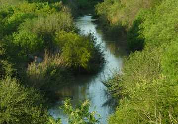
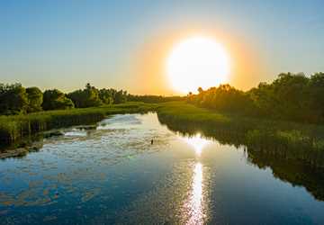
“The river was used a whole lot for fishing in the past, which was nice,” said Victor Gutierrez, AgriLife Extension associate at TWRI. “But under current circumstances, you can’t get near it anymore, and it’s a shame because it’s a really pretty river.”
Gutierrez’ family has lived and farmed in the Rio Grande Valley for generations. He explained that riverside farmers have had to alter the way they do business — literally — because of the suspected drug cartel activities on the opposite side of the river, particularly at night.
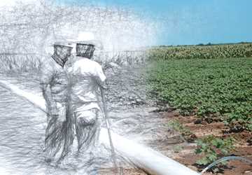
“My family who farms in the Valley can only be out there irrigating when there’s sunlight now,” Gutierrez said. “Before you could irrigate day and night. There wasn’t anything wrong. The only thing you’d see was ocelots, bobcats or feral hogs, and that’s it. But now, you can’t do that.”
Flores said that while the activities of drug cartels represent safety problems, they aren’t the only ones. The expanded border wall — not to mention the recent increase in anti-immigrant sentiments and anti-Latino racism that helped fuel its creation — poses literal safety risks too.
“We know where there are immigration problems, and we know where the drug routes are, but the walls are not effective,” Flores said. “If you do put a wall in there, and the river decides to wake up, now you’ve endangered people by creating a flood risk if that segment of wall goes tumbling down the river. The river can undo any man-made thing if it wants to.”
Hurricane Hanna of July 2020 seemed like it might wake the river up to do just that. Floodwaters further eroded an already shaky foundation to a segment of wall according to joint reporting by the Texas Tribune and ProPublica.
Flores, who grew up in the Rio Grande Valley and whose grandparents came to the U.S. from Mexico as farmworkers, described the river as an integral part of life along the border, making efforts to deepen the separation between communities hard to watch.
“People get very excited when you start messing with the river. The levees they understand. The walls they do not. And it’s seen as a very bad symbol,” Flores said.
“A lot of people down here have family on both sides. Sometimes the river is the only thing that separates these families. Anybody along the river would tell you the same thing. It’s just part of the fabric of life. It’s part of everything they do.”
Putting the pieces together for a whole picture of a river
Though there are issues that make it difficult to see the river as a whole, looking at the river holistically could be the key to its future.
“We have a whole natural system that is being managed in very different ways. That’s an issue that we need to address to cope with the consequences of the different management approaches,” said Nava.
For many experts, a more comprehensive approach to the river and its management is to again see it as a river. That is, a flowing river.
A lot of people down here have family on both sides. Sometimes the river is the only thing that separates these families. Anybody along the river would tell you the same thing. It’s just part of the fabric of life. It’s part of everything they do.
There have been many suggestions for getting the river flowing more regularly again. Improving agricultural water use via changes in irrigation techniques and switching to more drought- and saline-tolerant crops and slowing the growth of municipal water demands through improved efficiency could reduce demands on the water. More regular releases of water by Mexico in accordance with its 1944 Treaty obligations and keeping some of that water flowing through the existing dam system could help give back water to the river and its ecological needs. But none of those possibilities are simple, and one effort will not be enough.
“I think we can get to a point where the river can be, at minimum, sustained,” Sanchez said. “The problem is I don’t know if the river will be able to hold on that much until we all, everybody, agree that we need to do A, B and C in order to protect it.”
Shifting focus to the larger picture can threaten everyone’s own little pieces of the river according to Sanchez.
“When you make policies over water, you’re always going to get somebody mad and somebody really happy. Or everybody mad and then only the river happy,” she said.
“You don’t want to increase the price of water or reduce consumption because access to food and water is a human right. But we need people who are willing to take the time and the effort to sit down together to put together a decent, meaningful minimum plan to protect the river for the future.”
Sanchez and others voiced skepticism that the river will ever be allowed to reach its full potential as a river because human priorities will always drive the discussion. But more people are starting to realize the need for the discussion and consider the whole picture of the river.
“The river is a source of conflict,” Sanchez acknowledged. “But it is also a potential resource for cooperation.”
Explore this Issue
Authors
As communications manager for TWRI, Kerry Halladay provided leadership for the institute's communications. As a strategic coordinator, she served as liaison between AgriLife's Marketing and Communications department and the client groups: TWRI, the Natural Resources Institute, the Norman Borlaug Institute for International Agriculture, and the Institute for Infectious Animal Diseases.